We found 1790 price guide item(s) matching your search
There are 1790 lots that match your search criteria. Subscribe now to get instant access to the full price guide service.
Click here to subscribe- List
- Grid
-
1790 item(s)/page

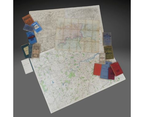
Lot 3343
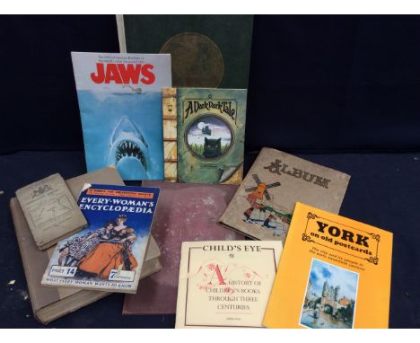
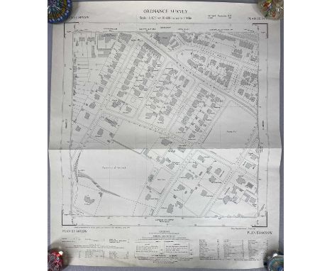
A mixed lot of books and others to include: a Short-Title Catalogue of Books printed in England, Scotland & Ireland 1475-1640, printed in 1926; a leather bound Atlas with various World Maps inside marked Atlas Antiques; a segment of English Bookbinding's paper book (no binding and incomplete), with images of front and back covers on first page, The Readers Digest Great World Atlas; a scrapbook album of Christmas related scraps; Every Woman's Encyclopaedia book; the official souvenir brochure of Jaws film; York on old postcards; Child's Eye, a history of children's books through three centuries; a journal with handwritten notes and verses inside with some small drawings; an Ordnance Survey folding map; A Dark Dark Tale book and two Roger Dean printed postcards "Osibisa Woyaya" and "Virgin", along with a small collection of 1930s handwritten letters with stamped envelopes and postal marks, and a piece of embroidered silk of floral design (with loss). Further details: some loss, wear, marks, stains and damage to some.

Lot 208
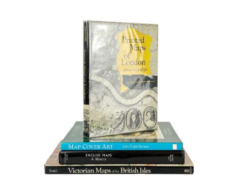
(Cartography) Four works Darlington & Howgego. 'Printed Maps of London 1553-1860,' clipped dj, fine, George Philip & Son, London, 1964; David Smith. 'Victorian Maps of the British Isles,' unclipped dj, vg to fine, BT Batsford, London, 1985; Delano-Smith & Kain. 'English Maps. A History,' signed, unclipped dj, the British Library, 1999; John Paddy Browne. 'Map Cover Art. A pictorial history of Ordnance Survey cover illustrations,' unclipped dj, fine, Ordnance Survey, London, n,d. (4)
Lot 656
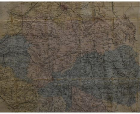
Ordnance Survey Map of the Avon Gorge 1886. OS sheet Somerset III.13 and Gloucestershire sheet LXXI.11 & 15. Scale 25 inches to the mile, size 138 by 138 cm, Hand-coloured. Includes the Avon Gorge, Abbots Leigh, Leigh Court, the George Inn, Leigh Woods, Clifton Down station, the suspension bridge and parts of Clifton Down, Sneyd Park and Ashton Court in slipcase; OS map that seems to have been used in the planning or construction of the Weston, Clevedon and Portishead Light Railway, Ordnance Survey, Southampton 1903. Scale 25 inches to the mile, an early OS map of South Gloucestershire and the Bristol area in a slipcase and one other (4)
![WWI military interest:- 1920 [1917] A Handbook of Arabia Volume I. I. D. 1128. Compiled b the Geographical Section of the Nav](https://cdn.globalauctionplatform.com/3f1f9405-3b05-425d-a5bc-b299011468bc/9dff6280-48a3-4433-b276-b2e4011f01d6/468x382.jpg)
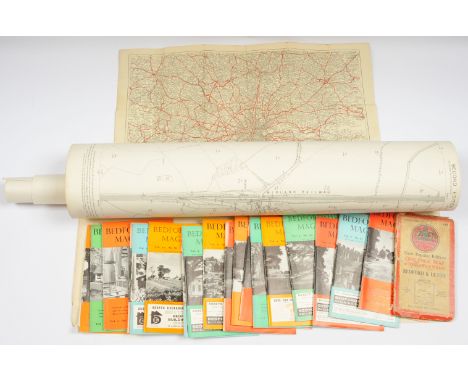
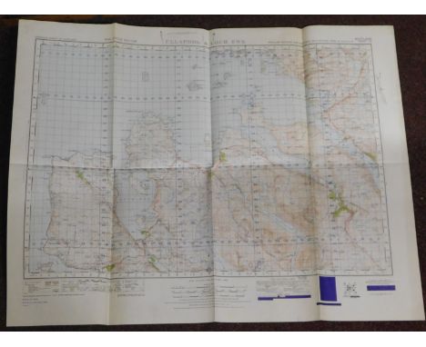
Lot 340
WWI military interest:- 1920 [1917] A Handbook of Arabia Volume I. I. D. 1128. Compiled b the Geographical Section of the Naval Intelligence Division, Naval Staff, Admiralty. London: published by His Majesty's Stationery Office. Publisher's worn cloth, spine broken through centre & with both flaps loosening, some instance of loss to boardsextremities bumped and edgeworn; ownership bookplate of Evan Guest to front pastedown, later biro ownership inscr. to ffep, binding tender. With four folding maps loosely inserted in pocket to rear, being Tribal Map of Arabia Ordnance Survey 1916, Arabia Land Surface Features, Arabia Orographical features, and Arabia - Disctrict and Towns; folded, remaining in very bright condition with just minor age-toning to edge. Loosely inserted, a mid century c1940s review of this work, 5 leaves manuscript in ink. A scarce First World War Admiralty produced map of the Arab regions. 8vo, maps measuring approx. 47cm x 38cm. (1)
Lot 882
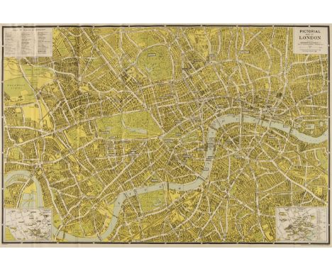
One Box of 19th and early 20th century MAPS, mostly cloth backed and comprising seven Sifton, Praed & Co. Ltd, maps of Hampshire, an Ordnance Survey Road Map of Southampton, Portsmouth and Isle of Wight, a Langley & Belch map of Hampshire, pub. 1817, an Ordnance Survey map of Aldershot and Envs. c1890, a map of London, drawn and engraved expressly for the Post Office Directory 1907, Phillip' Handy-Volume Atlas Of London, 1896, an Ordnance Survey map of London 1896, 'The Circuiteer' Invented by J. Friederichs To Serve As A Guide For Ascertaining Cab Fares, Porterage, etc, etc, No.1 London, a Lett's Pocket Map of London, Stanford's Map Of The River Thames From Richmond To Lechlade, Ravenstein's Oarsman's And Angler's Map Of The River Thames, c1900, The Oarsman's And Angler's Map Of The River Thames, pub. 1885, Crutchley's Road And Railway Map Of The County Of Hertford and A Pocket Map Of The East Sussex Hunt With A List Of Meets and A Table Of Distances, pub. James Dorman, 1882, a Geological Survey of Penzance/St Ives published by The Ordnance Survey, 1909, Crutchley's County Map of Cornwall, showing all the Railways & Names Of Stations, also the Villages, Turnpike Roads, Gentlemens Seats &c.&c, Bacon's Large Scale Plan Of Plymouth, Outline Or Skeleton Maps Of The Diocese Of Exeter Part 1, Containing In Thirteen Plates The Archdeaconry And County Of Cornwall, 1825, Island Of Guernsey, pub. F.B. Guerin, 1888, a Scale Survey Map of Sark, A New Map 0f the County of Gloucester, Divided into Hundreds by R. Rowe 1811
Lot 890
One Box of 19th and early 20th century MAPS & EPHEMERA, many maps cloth backed and hand coloured, comprising a Plans Of Towns To Accompany Bradshaw's Continental Railway Guide & General Handbook containing 24 Plans of Towns in Europe, three Crutchley's Railway Station Maps of the Counties of Lancaster, Cheshire, Somerset and Monmouth, an Underground Railway Map, number 1 - 1937, an Official Railway Map Of England & Wales, issued by the Railway Clearing House c.1921, a map Of The Meetings Of Friends In England And Wales, c.1840's, a Geological Map Of England And Wales With All The Railways by Sir Roderick I. Murcison, 5th Edition 1864, Bartholomew's Handy Touring Atlas Of The British Isles, Seventh Edition 1923, Phillip's Handy Administrative Atlas of England & Wales 1928, An Atlas to Guthrie's Geographical Grammer, 1818, An Admiralty Chart Of The Baltic, 1854, a hand coloured map of parts of Switzerland and Germany, a 1925 Travelers Map Of Japan inc Chosen (Korea) and Taiwan (Formosa) issued by Japanese Government Railways, Departmens Francais Reunis. Drome, Ardeche,Hautes & Basses, d'apres Cassini et le Depot de la Guerrre, Languedoc, Dauphine Et Provence, pub. H. Langlois 1853, a Miniature Atlas And Gazetteer Of The World by J.G. Bartholomew, c.1894, Skikarte Oetztal Kaunertal zum Timmeltal, pub. 1941, a Historical Map Of Scotland by L.G. Bullock, pub. John Bartholomew, cloth 5, 2 W.H. Smith Ordnance Maps of Central Wales and South East Wales, Bacon's Large Scale Plan Of Dublin 'Geographica' Large Scale Street Plan Of Liverpool, Emmanuel Bowen's Northamptonshire, c.1700's, four Edward Stanford maps of parts of Staffordshire and Shropshire, c19thc, a 1908 map of Rugeley, a 1906 Ordnance Survey map of Macclesfield and District, a 1921 Ordnance Survey Map of Derby, a 1921 General Map To The District of Derby, pub. J.W. Harding & Co. a 1914 Map Of The County Borough Of Derby, pub. Bemrose & Sons, The Central Cycling and Motoring Map Of Derby District, Woore's County Map Of Derby For Cycling, Motoring, Touring and Rambling, Cruchley's County Maps of England - Derby, c.1880, four WWII German maps and four pieces of ephemera comprising a Manchester Corporation Water Works Map, 'Dockinization v Docks' Letters and Plans Sent To The Mayor and Corporation Of Bristol, 1893, an 1882 card ' The New Colossus Of Roads, Atchison, Topeka and Santa Fe Railroad and a 17thc book 'The Cries Of London'
Lot 8422
(Snettisham, Norfolk, Friendly Society.) A circa late C18th printed document "Articles and Orders Agreed to by a Select Company of Persons, Under the Denomination of a Friendly Society, Meeting at the Sign of the Compasses, at Snettisham, kept by William Parfrement, Whereas several sociable and well-disposed people considering the ill consequences...in case of sickness, lameness or any other infirmity, having thought proper...to raise a common stock, or purse...", the document with some manuscript pen & ink notes to margin, signed "Robert Fowell" lower right and m/s dated (appears to be "March 21 96", possibly 1796?), framed and glazed, the whole size 55 x 44cm. Before modern insurance and the welfare state, friendly societies provided financial and social services to individuals, often according to their religious, political, or trade affiliations. Friendly societies generally met people’s key needs: They provided an insurance against two major fears: sickness (and with it unemployment and poverty) and death. Local societies were small local informal groupings of people, often based in the local pub. For most people in the early 19th century their life was conducted within a half-days’ walk. Local societies would provide for people within a reasonable walk of the village pub – maybe two or three miles. The building was built in the late 18th century and is visible on the 6 inch 1st edition ordnance survey map (1879-1886). It is known that in the 19th century the building was used for Petty Sessions and County court business.
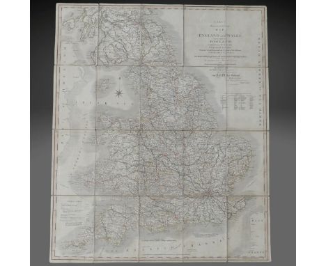
Lot 204
Cary (John); 'Cary's Reduction of his large Map of England and Wales...', published by the author Feb. 20th 1796 corrected to the year 1815, dissected and laid onto linen, no slip case, together with a quantity of 19thC folding county maps, including 1881 Ordnance Survey Sheet 102, Ross-shire, in Edward Stanford slipcase, Wyld's Kent in slipcase, 'Smith's New and Accurate Map of the Lakes...', July 1802 in slip case, etc., (13)
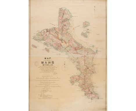
Lot 91
Seychelles. Hobbs (S. B.), Map of the Island of Mahé, Seychelles. Made in Accordance with Ordnance No. 7 of 1898. Based on Survey by Commander Balfour, H M S Stork 1890, and showing the Principal Landed Properties as Compiled from Various Plans and other Sources and Laid down by Traverse of Roads and Paths by S. B. Hobbs, Island Surveyor, Port Louis Mauritius: 27th September 1900, lithographic map with contemporary wash colouring, printed on two conjoined sheets and laid on linen, old ink library stamp of the Royal Colonial Institute Library, horizontal fold, trimmed with slight loss to the printed borders along the horizontal margins, slight dust and finger soiling, slight staining, 905 x 625 mmQTY: (1)NOTE:Provenance: From the Seychelles collection of Sue Hopson.A rare map with only one institutional copy found (British Library). The map is regarded as the first comprehensive survey of Mahé, the principal island of the Seychelles. Hobbs has made use of the surveys undertaken by the crew of the HMS 'Stork', under the Command of Andrew Francis Balfour, in 1890. However, Hobbs concentrates on the interior of the island, noting its topography, settlements, and civil infrastructure. The island was a French colony from 1721 and wasn't formally returned to India until 1954, resulting in many of the place names being in French.
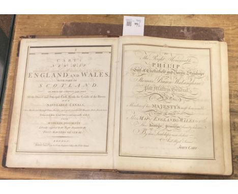
Lot 99
Cary (John). Cary's New Map of England and Wales with part of Scotland on which are carefully laid down all the Direct and Principal Cross Roads, the Course of the Rivers and Navigable Canals..., 1st edition, 1794, engraved title and dedication leaves (both with ink stamp J.J. Pitcairn to upper margin), general map of England & Wales with contemporary hand-colouring, engraved table of explanation and scale leaves, seventy-seven engraved maps with contemporary hand-colouring (fore-margin of sheet 27, 41 & 42 repaired, long repaired closed tear to sheet 50), index and list of subscribers bound at rear (browning to final leaf), some offsetting, occasional light dust-soiling, 19th-century half morocco, worn and vertical split to spine, 4to, together with:Ordnance Survey. Ordnance Survey Atlas of England & Wales, quarter inch to the mile, Southampton: printed at the Ordnance Survey Office, 1922, double-page colour lithograph linen-backed maps, original cloth, lacking spine, marked and worn, oblong folio QTY: (2)
![* Worcestershire. Speed (John), Worcestershire Described, John Sudbury & George Humble [1627], hand-coloured engraved map](https://cdn.globalauctionplatform.com/dbf67710-f959-4453-bf24-b2b50118f665/36ad0c2b-8a63-4e53-b9ac-b2d1010bdd79/468x382.jpg)
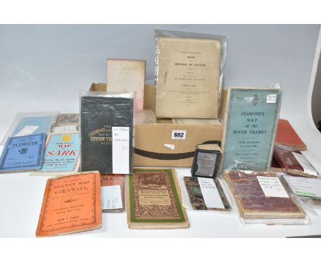
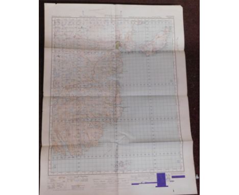
Lot 228
* Worcestershire. Speed (John), Worcestershire Described, John Sudbury & George Humble [1627], hand-coloured engraved map, an inset town plan of Worcester, large strapwork cartouche, mileage scale and compass rose, 385 x 510 mm, framed and double-glazed, English text on verso, together with Cary (John). Cary's New Map of England and Wales with part of Scotland..., 1794, dedication and printed title with slight staining, list of roads, index and table of explanation, general map of England & Wales and 76 (complete) engraved map sheets (numbered 1-81 and omitting 62/63, 71/72 & 80 as intended), all with contemporary outline colouring, some dust soiling throughout, index and list of subscribers bound at rear, contemporary booksellers stamp (John Bally of Bath) to the front pastedown, contemporary gilt mottled calf, heavily worn and rubbed, upper board detached, 4to, together with Van Brée (Sir Matthew). Compendious View of Universal History and Literature in a Series of Twenty Tables..., 4th edition, London: 1833, title page with near-contemporary ownership signature, dedication to Queen Victoria, preface and list of subscribers, 21 tables (20 double-page), 20 with contemporary wash colouring, double-page explanation of the colouring bound at rear, marbled endpapers, contemporary half morocco gilt, rubbed and worn, slim folio, with Blackwood (William, publishers). Blackwood's Atlas of Scotland..., Edinburgh: 1839, double-page title, contents list, 31 (complete as list) double-page maps, engraved by W. H. Lizars, all with contemporary outline colouring, slight dust soiling, contemporary gilt half calf, bumped with slight wear, 8vo, plus Fullarton (Archibald). A Collection of 44 County Maps, circa 1840, uncoloured engraved maps, some dust soiling, slight spotting, each approximately 255 x 190 mm, another 24 maps and atlases, including examples by or after Ordnance Survey, Blome, Paterson, Houlston & Son, Richardson and Arrowsmith, various sizes and conditionQTY: (approx.72)
Lot 195
Maps and Cartographic Ephemera. A collection of approximately 50 items, 19th & 20th century, including folding maps, advertisements and catalogues, portraits of cartographers and explorers, 2 volumes of the Map Collector's Circle (11th volume numbers 104 & 105), on portraits of geographers and cartographers, Ordnance Survey, a cartographic jigsaw puzzle, and a few topographical views of London (each view with a literary or a cartographic emphasis), together with McCall (Taylor). Behind Us, Bocaccio Books, Stockbridge: 1970, hand-coloured illustrations throughout, limited signed edition 230/300, marbled endpapers, publisher's morocco with gilt design to the upper siding, spine sun-toned, contained in a contemporary cloth slipcase, small folio, with Blaeu (Johannes). Rutlandia Comitatus Rutland Shire, Amsterdam: [1645 - 61], engraved map with bright contemporary hand-colouring, large margins, 385 x 500 mm, Latin text on verso, together with Regiones Inundatae in sinibus comitatus Norfolciae, Suffolcia, Cantabrigiae, Huntingtoniae, Northamtoniae et Lincolniae, Amsterdam: circa 1650, engraved map with contemporary hand-colouring, slight creasing, 440 x 545 mm, no text on verso, Kitchin (Thomas & Jefferys Thomas). A Map of Surrey, circa 1787, engraved map with contemporary hand-colouring, descriptive text below the map, 185 x 145 mm, together with Moule (Thomas). Surrey, circa 1848, uncoloured engraved map, unusually large margins, central fold strengthened on verso, 220 x 270 mm, with Collins (H. G.). The British Gazetteer. Surrey, circa 1850, hand-coloured engraved map, old folds, 355 x 430 mm, plus Mogg (E.). London to Southampton measured from Hyde Park, 1814, strip road map with contemporary hand-colouring (the map commences at London and ends at Hounslow Heath), 235 x 165 mm, and three copies of a hand-coloured view of Twickenham, originally published in Harrison's 'History of London', each 175 x 290 mmQTY: (approx.60)
Lot 168
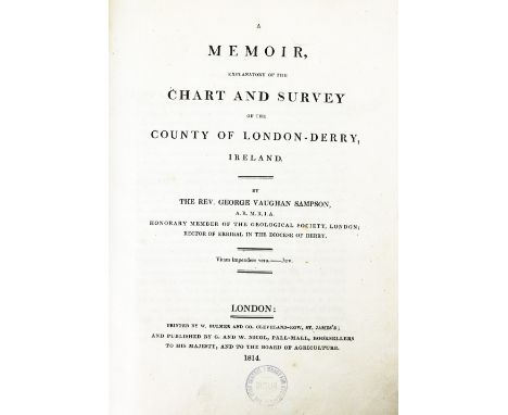
Sampson (Rev. Geo. V.) A Memoir, Explanatory of the Chart and Survey of the County of London-Derry, Ireland, Folio Lond. 1814. First Edn., list of subscribers, dble. page litho view, fold. map & 6plts. some text illus. uncut, recent cloth; Colby (Col.) Ordnance Survey of the County of Londonderry, lg. 4to Dublin 1837, cold. map fold. plan & other plts. text illus. recent cloth. (2) Ex. Library Copies.
Lot 160
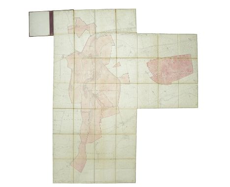
AN ORDNANCE SURVEY MAP OF KNOCKLOFTY ESTATE, CO. WATERFORD, 1908linen backed fold-out map, there is one fold-out in 37 sections, with hand written annotations for areas of land that have been sold 'To Captain Robinson' & 'To E. C Power', published by Ordnance Survey Office, Phoenix Park, Dublin, bound in half red leather with cloth boards, spine with gilt lettering and dated 1911. The map 235 x 182cm (irregular)
Lot 123
Maps & Ephemera, early 20th Century to include Bartholomew (J. G.) The Pocket Atlas and Guide to London, 1893; Coplow (Billesdon) A Poem on Fox Hunting, London: T. Griffiths, 1833; Geographia, Plan of London and Suburbs, folding map, n.d.; Dibdin (Charles) The High-Mettled Racer ... illustrated ... by G. W. Bonner, London: William Kidd, 1831; Gross (Alexander), Pictorial Map of the Thames and Medway Valleys, London: Geographia, n.d.; Bartholomew (John) Middle East and Near-East 1:4,000,000, 1956; together with multiple further Ordnance Survey and other maps of England, Wales and France (qty)
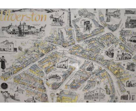
Lot 1305
Local interest* A pictorial map of Ulverston, monochrome with some lightly coloured areas, printed by Reminder press for The Furness Tourism Partnership and Ulverston 2000+., within a stepped card mount and mouded wooden frame, under glass 41cm x 58cm & 63cm x 80cm overall. Sold together with an unframed map of Ulverston as it was in 1850, based on the Ordnance Survey County Series Map Lancashire XVI Survey of 1850, mounted to pink card but unframed 55.5cm x 63cm overall
Lot 1034
A Quantity Of Sheffield Related Items, to include Sheffield Corporation And British Railways Tramway & Omnibus Time Table 1958, Sheffield Transport Motorbus Fleet List 1971, Sheffield & Doncaster Ordnance Survey Map 1910, Sheffield & The Peak District Ordnance Survey Map 1911, Les Steel Cufflinks, Kayser Ellison & Co Catalogue, KRIS by Billam Dessert Knives, etc, together with a box of Travel Books including Alan Wainwright The Pictorial Guides To The Lakeland Fells 50th Anniversary boxset And A Vintage Cadbury Tin With New Hey Tokens:- Two Boxes.
Lot 670
MAPS: Saxton Map of Wiltshire 1637, with hand-colouring: together with 'The Railway Bell and Illustrated London Advertiser Map of London' (1845), poor condition: with, 3 framed maps of Islands after Thomas Bowen (late 18thc): plus a roll of Ordnance Survey large scale maps and a bundle of posters, plans, diplomas, etc. (Small Qty)
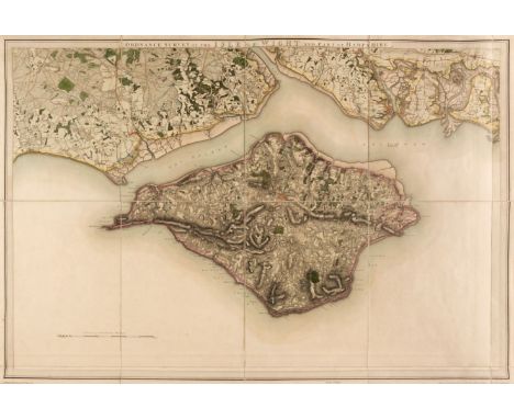
Lot 104
Isle of Wight. Baker (Benjamin), Ordnance Survey of the Isle of Wight and Part of Hampshire, Tower of London: Colonel Mudge, 1st June 1810, large engraved map on a scale of one inch to the mile, contemporary outline colouring, sectionalised and laid on linen, slight offsetting and dust soiling, 630 x 920 mm, together with Walker (J. & C.). England South Coast Dunnose to the Needles including Spithead, Surveyed by Captn. Sheringham R. N. published at the Hydrographic Office of the Admiralty, Sept 1st 1852, large engraved hand-coloured sea chart, inset map of Southampton Water, numerous horizon profiles, old folds, slight dust soiling and creasing, 645 x 970 mmQTY: (2)
Lot 908
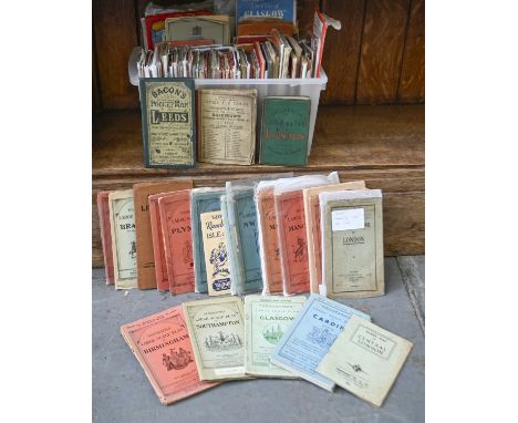
Maps. A collection of approx. 80 folding maps, 19th c and later, including a defective copy of Bradshaw's Plans of the Cities and Town of Continental Europe, n.d. [c. 1870], publisher's binding; Bacon's New Pocket Map of Leeds, n.d. [c. 1895], green cloth boards; Gall & Inglis' Handy Map & Guide to London, n.d. [c. 1900], green cloth; "Geographia" New Plan of the City of Glasgow, c. 1930; further British maps, various cities, regions, publishers, including Ordnance Survey & Bartholomew's, mixed sizes and bindings Mixed condition
Lot 544
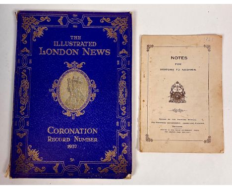
MAPS (etc.). An interesting group of mainly 'colonial' items (and mainly sub-continental) from early 20th C.: 'Afghanistan & North Western Frontier Province - Kabul, Peshawar District, Khyber and Tribal Territory'. 'The Hashimite Kingdom of Jordan', Road Map, 1956, Ordnance Survey. Then 'India and Adjacent Countries', 1929 (Ryder, Surveyor General of India). Also 'The North Atlantic Lane Routes'. And two oddments: 'The Illustrated News Coronation Number', 1937, and 'Notes for Visitors to Kashmir', 1934.
![England & Wales.- Ordnance Survey.- [Ordnance Survey of England and Wales, on the Scale of One Inch to a Mile], 81 map sheets](https://cdn.globalauctionplatform.com/9b60799e-9906-42b6-a5f7-b29d0101d393/a5ca0b65-0740-499e-b698-b29d01252268/468x382.jpg)
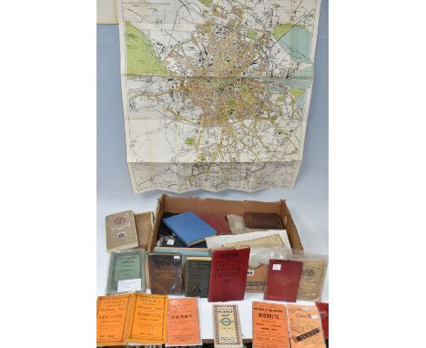
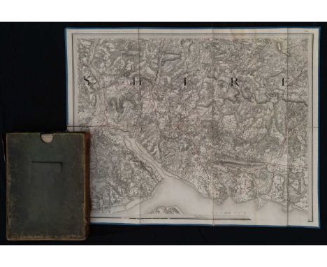
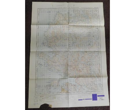
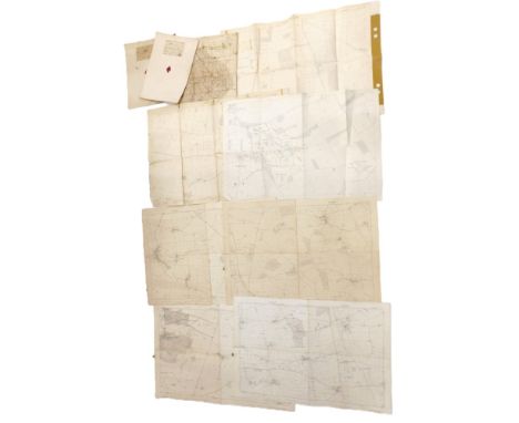
Lot 267
England & Wales.- Ordnance Survey.- [Ordnance Survey of England and Wales, on the Scale of One Inch to a Mile], 81 map sheets only (of 88: lacking 77, 78, 80, 81, 82, 87 & 88: Anglesey, Cheshire, N.Derbyshire & S.Yorkshire) and Index sheet in 22 boxes, engravings, each sheet c.650 x 960mm., dissected and mounted on linen edged in blue silk with numbered vellum thumb tabs (one or two missing), with pink diamond paper stickers to versos, occasional soiling, folding into 22 black straight-grain morocco boxes with decorative borders in gilt & blind and pull-off lids, spines titled and numbered in gilt, gold paper edges, a little rubbed and scuffed, some corners damaged, but a handsome set, large 8vo, Lt.Col. Mudge [& Colby], The Tower, 1805-24.*** The maps cover the whole of Southern England and Wales, ending at the River Humber in the north. The Index sheet (dated 1824) extends only to sheet 84 (North Lincolnshire) with 80 & 81 (listed as Northwich and Buxton) appearing blank. This set contains 85 & 86 up to the Humber but lacks 87 & 88 (listed as S.Yorkshire on spine of box).
Lot 46
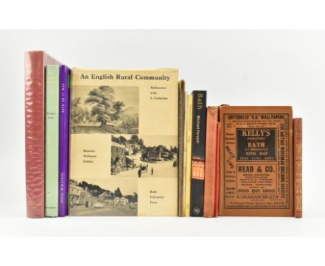
Bath, Somerset local interest. A collection of mostly 20th century reference works on the history of the city of Bath. The lot to include 1893 Streetlore of Bath by R. E. M. Peach, The Bath Tramways by Colin G. Maggs signed by the author to title page, Bath by Michael Forsyth, The Georgian Buildings of Bath by Walter Ison, Roman Bath by Barry Cunliffe (Reports of the Research Committee of the Society of Antiquiaries of London), Bath As It Was in Historic Photographs by Reece Winstone, An English Rural Community - Batheaston publ. Bath University Press, Edwardian c1910 Views of Bath and Neighbourhood, Pictorial Guide to Bath - Pageant Edition, Bath Ordnance Survey folding map in cloth wraps, The Penny Illustrated History of Bath and District, Kelly's Directory of Bath 1932, and The Life of Beau Nash by Oliver Goldsmith The Panel Books edition. A smart & varied collection, illustrated with historic photographs of the city. Largest 4to.
Lot 477
John Cary, Cary's New and Correct English Atlas, 1793John Cary, Cary's New and Correct English Atlas: Being a New Set of County Maps from Actual Surveys..., printed for John Cary, Engraver, Map and Print-seller, No.181 near Norfolk Street, Strand, published as the act directs Jan 1st 1793, large Quarto, full leather period boards, recent spine and binding replaced end papersJohn Cary (c. 1754–1835) was a prominent English cartographer, engraver, and globe-maker, celebrated for the precision and artistry of his maps. Renowned for his attention to detail, Cary played a significant role in elevating cartography to both an art form and a practical science. His surveys and innovative methods earned him commissions from various government bodies, including the Ordnance Survey, where he worked to establish accurate baselines for mapping.Cary's atlases, globes, and road maps became essential tools for travelers, geographers, and planners during the late 18th and early 19th centuries. His New and Correct English Atlas is considered a landmark in British cartography, influencing the way maps were designed and utilized. Cary’s commitment to accuracy and clarity set new standards for the field, ensuring his legacy as one of England’s finest mapmakers.Book Description: The 1793 edition of Cary's New and Correct English Atlas is a carefully revised and expanded version of the original 1787 publication. This second edition reflects John Cary’s dedication to precision and includes updated maps based on actual surveys. Featuring a complete set of English county maps, the atlas is accompanied by descriptive text, providing geographical, demographic, and historical insights for each county.The maps are finely engraved and hand-colored, showcasing Cary’s mastery in combining scientific accuracy with aesthetic appeal. The second edition incorporates corrections and enhancements to the original plates, reflecting the evolving understanding of England’s geography in the late 18th century. Cary’s clear and detailed cartographic style made this atlas an indispensable tool for planners, travelers, and scholars of the era.This 1793 edition offers a rare glimpse into Georgian England’s geography
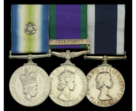
Lot 493
The South Atlantic and Lebanon operations group of three awarded to Leading Air Engineering Mechanic (Electrical) P. Roberts, Royal Navy, who flew on operational missions as an ‘extra gunner’ in Sea King helicopters in the Falklands, prior to qualifying for the rare ‘Lebanon’ clasp for like services South Atlantic 1982, with rosette (ALAEM(L) P Roberts D112421W 846 Sqdn); General Service 1962-2007, 1 clasp, Lebanon (ALAEM(L) P Roberts D112421W RN); Royal Navy L.S. & G.C., E.II.R., 2nd issue (ALAEM(L) P Roberts D112421W RN) mounted as worn, nearly extremely fine (3) £1,400-£1,800 --- Importation Duty This lot is subject to importation duty of 5% on the hammer price unless exported outside the UK --- --- Peter Roberts was born in Merionethshire, Wales on 27 September 1953, and joined the Royal Navy as an Engineering Mechanic (Air) in June 1969. Having worked on Canberra aircraft and Wessex helicopters in the interim, he joined No. 846 Naval Air Squadron (N.A.S.) in September 1980. And it was in this capacity that he journeyed south to the Falklands in the carrier Hermes in April 1982. By Robert’s own account, he subsequently flew operational missions as ‘an extra gunner’ in the squadron’s Sea King helicopters, in addition to assisting in the preparation of a Wessex helicopter for an S.A.S. mission to the Argentinian mainland: stripped down for maximum speed and range, it dropped off an S.A.S. recce team before flying to Chile; the helicopter was torched on landing and the crew repatriated via the (neutral) German embassy. It was during his tour of duty in 846 N.A.S. that Roberts also participated in the Lebanon operations of February 1983 to March 1984. One of the unit’s helicopters, and seven support personnel, were transferred to the support ship Reliant, from which he made several trips to Lebanon, acting as an ‘Air Gunner operating a machine-gun, plus a chaff dispenser.’ Roberts was finally discharged in May 1987. Sold with the recipient’s hand-written summary of the salient points of his career, together with an Ordnance Survey map of San Carlos Bay, showing missile sites; a ‘Crossing the Line’ certificate; Grin & Bear It booklet published by the Falklands Task Force; Intrepid Observer magazine published on board the Intrepid, and a copy of his Royal Navy Certificate of Service.
Lot 996
Collection of Approximately 10 WW1 Trench Maps:Including: 1. Belgium and Part of France, Scale 1:40,000, Dated January 19182. France, Scale 1:250000, Published by the War Office 1914, Reprinted 19333. Gouzeaucourt Scale 1:20000, Details and Trenches Revised 24-10-174. Battle Area around Ypres 1:100005. Map No 61 Trenches Corrected to 3-9-17 Scale 1:10000 N.Corps Topc 6. Gouzeaucourt Scale 1:20000, Details and Trenches Revised 8-12-177. Trenches Corrected Edition 7.A 4-3-17 Scale 1:100008. Gonneliieu Edition 3A Trenches Corrected to 30-9-17 Scale 1:100009. Spriet Scale 1:10000 Edition 1 - Trenches Corrected From Information Received to 4-10-1710. France 1:40000 Edition 1 Ordnance Survey Dated January 1918France, Scale 1:250000, Published by the War Office 1914, Reprinted 1933 by the War Office. Others may also be reprints, but the majority look to be Original maps from the period. Please view the images.
Lot 397
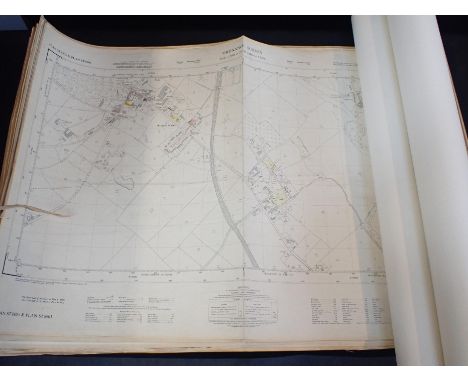
Cartography - Nottingham maps: Ordnance Survey 1:2500 (6in:1 mile) sheet XXXVIII SW 1902; 25in:1 mile planning map of New Lenton and Old Radford accompanied by numerous typed planning schedules rolled with a variety of plans on tissue (qty); Town Planning - Nottingham Corporation, 6 large maps of housing schemes with a number of other, related, items, 1934; planning maps of Sneinton, 1933; maps relating to sale to Nottingham Corporation of land Sneinton Dale and Cardale 1933; map of proposed layout of the Colwick Estate, Nottingham, 1925 (qty); colour printed index chart of 25in OS maps of Derbyshire, as revised to 1899; another similar index chart of both 6in and 25in maps of Derbyshire, monochrome (2) (quantity)
Lot 442
World War One British War Medal and Victory Medal pair officially named as issued to 33477 PTE. W.R. DOBSON. MANCH.R. According to online sources, Private William Robert Dobson served with 16th Battalion Manchester Regiment during WW1 and was entitled to the BWM and VM. Sold together with World War Two Defence Medal And War Medal, contained within the box of issue with damaged label partially obscuring initials of name, as sent to 'R.B. Dobson Esq' at an address in Lancaster and with original compliment slip and 'ticker tape' annotated 1155402 CPL confirming award of the two medals. Also, a Battle for Britain Commemorative Medal with Royal Air Force clasp, in box of issue with Bomber Command Association card to Life Member William R.B. Dobson and Bomber Command Commemorative Medal in box of issue, together with two RAFA collar pins and VR cloth badge and two pencil sketches of individuals, several photographs WW1 period including a small Regimental group photo, an Ordnance Survey map of Midlands and Wales, annotated R.A.F. (WAR), a Royal Air Force Note Book for Workshop & Laboratory Records Form 620 completed by 1155402 Flight Mech/Rigg W. Dobson, together with Bomber Command Association sympathy card addressed to the wife of William R.B. Dobson. Also sold with several bullets and a number of military buttons and badges, including cap badges for RAF, ATS, Royal Warwickshire and several cloth patches, including Combined Operations, Commando and rank badges. (Lot)
![[ Cumbria ] An Ordnance Survey map of the Lake District, 1958, in contemporary wooden frame under glass, 108 cm x 89 cm overa](https://cdn.globalauctionplatform.com/1e7022d6-f976-4005-9170-b28a00c116a8/f038855e-0e8f-4e0f-9c69-b28b015d7344/468x382.jpg)
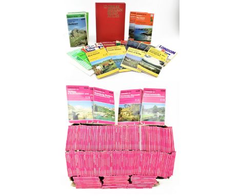
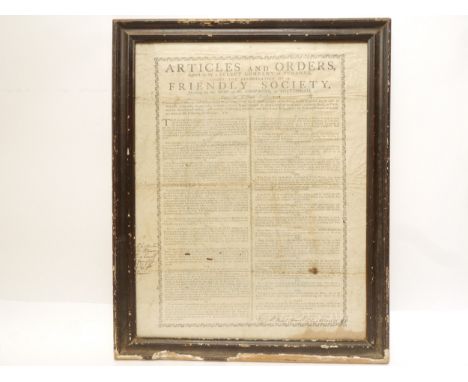
Lot 143
Ordnance Survey maps. A collection of 203 of the full series of 204 1980s & 1990s Ordnance Survey maps. Featuring all information regarding public rights of way & tourist information. 1:50000. Lacking No. 100 for Malton, Pickering and surrounding area. Some edgewear commensurate with age, remaining generally bright & smart otherwise. Along with a small collection of vintage atlases & c31 Pathfinder maps. A good collection.Each map measuring approx. 23cm x 13.5cm closed.
Lot 510
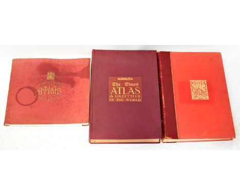
Three map books comprising John Bartholomew 'The Survey Atlas of England and Wales', 2nd edition, pub. 1939, with colour plates, in tooled red cloth cover and leather embossed spine, an 'Ordnance Survey Atlas of England and Wales 1922' and 'The Times Atlas & Gazetteer of the World', pub. J G Bartholomew 1922 (3).
-
1790 item(s)/page