We found 4033 price guide item(s) matching your search
There are 4033 lots that match your search criteria. Subscribe now to get instant access to the full price guide service.
Click here to subscribe- List
- Grid
-
4033 item(s)/page

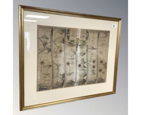
Lot 234
JOHN OGILBY; 'The Road from London to Hith in Com Kent, Including the Road by Maidstone', an 18th century engraving, 37.5 x 46.5cm, framed and glazed, a modern printed map of Australia, after the drawn and engraved map by J Rapkin, 27 x 34cm, framed and glazed, a further modern printed map of Western Australia, Swan River, 36 x 26.5cm, framed and glazed, and a small modern printed map of Kent (4).
Lot 914
SEVEN BOXES OF BOOKS AND CDS, approximately one hundred titles hardback and paperback format subjects include cars, cooking, hobbies, encyclopaedia, art, etc. approximately one hundred CDs to include music such as rock, pop, easy listening, musicals, jazz etc. also included a vintage Allday's standard map of Birmingham City, a road map Pembroke and Tenby, also a map of Peak District, (7 boxes), (sd/af)
Lot 8537
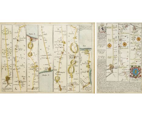
John Senex (British c.1678-1740): The Road from Lincoln to Bridlington and Flamborough Head, scarce French edition 18th century engraved road strip map with hand-colouring pub. c.1766, 16cm x 22cm; Emanuel Bowen (British 1694-1767) and John Owen (British 18th century): Lincoln to Kingston-Upon-Hull, early 18th century engraved road strip map with hand-colouring including the Arms of Kingston-Upon-Hull pub. Britannia Depicta; or, Ogilby Improv’d c.1720, 18cm x 12cm (2)
Lot 8536
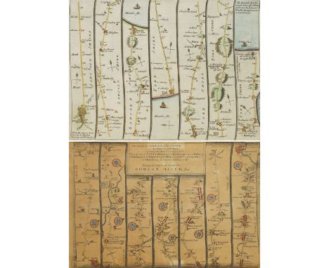
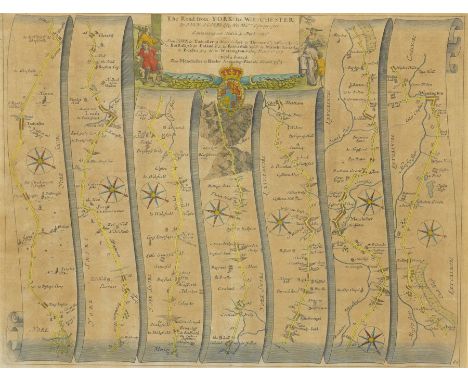
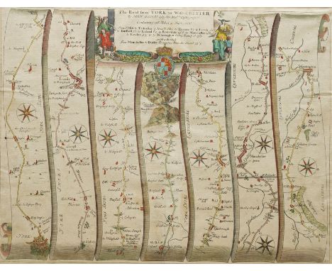
John Senex (British c.1678-1740): The Road from Lincoln to Bridlington and Flamborough Head and the Road from London to Kings-Lynn in Norfolk (framed verso), early 18th century double-sided engraved road strip map with hand-colouring pub. c.1719, 16cm x 22cm; Thomas Gardner (British fl. 1719): 'The Road from York to Lancaster', early 18th century road strip map with hand-colouring 19cm x 28cm (2)
Lot 8538
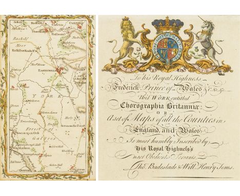
Mostyn John Armstrong (British fl.1769-1791): 'York', 18th century engraved road strip map with hand-colouring of York with Easingwold and surrounding towns pub. 1776, 17cm x 10cm; Thomas Badeslade (British fl.1719-1750) & William Henry Toms (British c.1700-1765): Frontispiece for 'Chorographia Britanniae' dedicated to Frederick, Prince of Wales, featuring an allegorical frame surrounding a dedication to the heir apparent, early 18th-century engraving with hand-colouring pub. c.1742, 16cm x 14cm (2)
Lot 8526
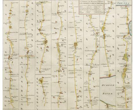
John Bowles (British 18th century): 'A Survey of the Road from London to Flamborough Head Yorkshire', scarce 18th century engraved road strip map with hand-colouring, commencing with the road from Kendall to Carlisle, followed by the road from Stilton through Peterborough and Lincoln to Hull and Beverley, ending at Flamborough Head, pub. 1757, 31cm x 36cm
Lot 66
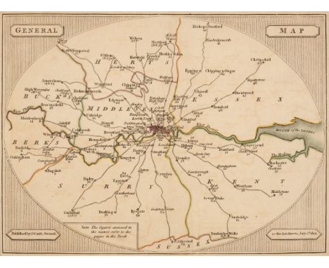
Cary (John). Cary's Survey of the High Roads from London to Hampton Court, Ware, Bagshot, Bishops Stortford, Oakingham, Chipping Ongar..., On a Scale of one Inch to a Mile; wherein every Gentleman's Seat, situate on, or seen from the road, (however distant) are laid down, with the name of the Possessor; to which is added, the number of Inns on each Separate Route; also, The different Turnpike Gates shewing the Connection which one Trust has with another, 1st edition, J. Cary, 1st July 1790, engraved title page, page of explanation, folding general map of London and its environs, plan of London depicting the turnpike gates, and 80 strip maps (complete) on 40 sheets, all maps with contemporary outline colouring, some offsetting, text block detached, contemporary calf, rubbed, worn and bumped, spine crudely repaired, 8voQTY: (1)
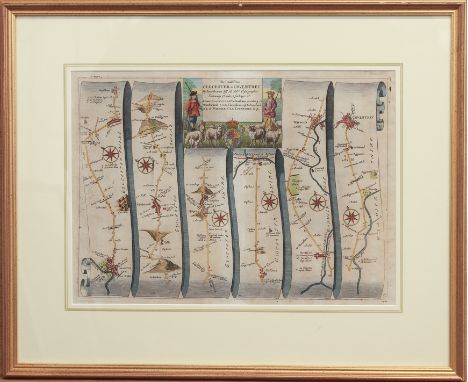
Lot 372
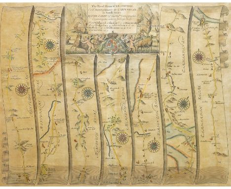
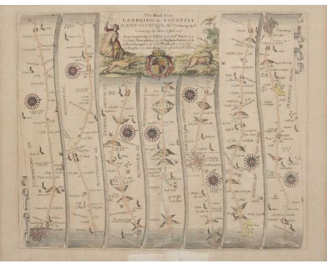
John Ogilby (Scottish, 1600-1676): a 17th century strip road map - 'The Road from Glocester to Coventry', via Cheltenham, Winchcombe, Chipping Campden, Stratford-upon-Avon and Warwick, hand coloured, with decorative title panel with royal arms, 12 x 17in (30.5 x 43.2cm), gilt framed. * Provenance: with The Map House, 54 Beauchamp Place, London, SW3
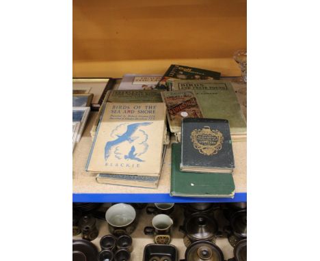
![Ryves (Mrs [Frances Catharine]) Cumbrian Legends; or Tales of Other Times: Dedicated to her Royal Highness the Princess Charl](https://cdn.globalauctionplatform.com/a1ce3109-4848-4ed7-a339-b2f300b2e457/6ba0344f-cdc9-4ddf-9dcd-b2f300b4e8d5/468x382.jpg)
Lot 203
Ryves (Mrs [Frances Catharine]) Cumbrian Legends; or Tales of Other Times: Dedicated to her Royal Highness the Princess Charlotte of Wales. By Mrs Ryves, of Ryves Castle, first edition, 16pp. list of subscribers at end, portion excised from title upper-margin, uncut in original boards, printed paper spine label, spine with small loss to foot and along joints, corners bumped, spine and corners quite worn, Printed for the Author, 1812 § Armstrong (Mostyn John) An Actual Survey of the Great Post-Roads between London and Edinburgh, third edition, engraved title vignette, general map of the Post Roads and 44 road maps, map 28 with short tear into image without loss, spotting or foxing, mainly at beginning and end, lightly browned, front free endpaper torn with small loss and working loose, contemporary calf-backed marbled boards, lacking backstrip, worn, Printed for, and Sold by the Author, and the Booksellers, 1777; and others, various subjects, including several 18th century almanacs, v.s. (c.30) *** The first mentioned scarce. The list of subscribers includes some located in the West Indies.
Lot 209
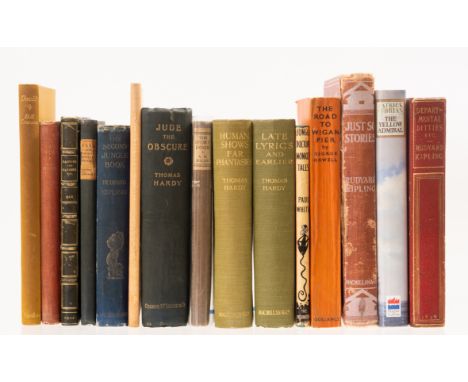
Milne (A.A.) The Ivory Door, signed by the author to title, the odd spot, spine browned, paper label to spine, edges uncut, 1929 § Hardy (Thomas) Jude the Obscure, etched frontispiece, map of Wessex, the odd spot or surface mark, extremities bumped and frayed to spine ends and corners, covers a little stained, [Purdy p.86-87] 1896 § Orwell (George) The Road to Wigan Pier, illustrations spotting to fore-edge, spine browned, spine ends and edges beginning to fray, covers a little stained, 1937, first editions, original cloth or wrappers; and others, literature, 8vo (15)
Lot 123
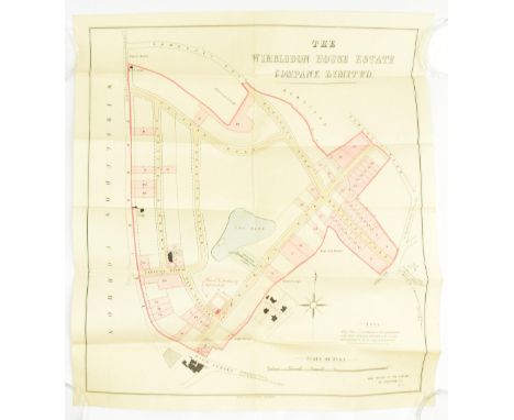
c1875-80 The Wimbledon House Estate Company Limited. A late Victorian early plan of Wimbledon to include The Estate Lawn Tennis Club. Folded in twelve sections on paper. Lith. Pettitt & Cox. Wimbledon Common to left hand side, the tennis club visible alongside the lake. Manuscript additions in red ink relating to a (not yet existing) property at the corner of Peek Crescent & Marryat Road & Hamptons Office added by hand on the corner of the high street, with estate boundaries added by hand. Hamptons Estate Agents were responsible for the sale of the estate. Some light ink marks to verso of sheet. An early map depicting the courts & grounds now renowned for one of the biggest & oldest tennis tournaments in the world. Measures approx. 62cm x 56cm.
Lot 998
A QUANTITY OF PICTURES AND PRINTS ETC, to include a Tom Maxwell dry point etching of Old West Kirk in Greenock, Henry G Walker etchings with colours, a pastel drawing of Elephants signed P. Goode, a watercolour of a feeding Elephant signed Keith Hill - some damage, an indistinctly signed limited edition print of Pawneese race horse, Tristram Hillier print 'The Blue Cart', Snow Hill Station print by Robert K. Calvert, George Romney Mezzotint print signed by the engraver, four reproduction Francis Wheatley prints, a John Owen and Emanuel Bowen road map 'Ashburton to Plymouth', an engraving of 'East View of Birmingham in Warwickshire', assorted other prints, two glazed display frames etc
Lot 270
Local Interest: John Ogliby (British, 1600-1676), hand coloured prints: 'The Extended Road from Buckingham to Bridgnorth', including the counties of Oxfordshire, Warwickshire, Worcestershire and Gloucestershire, 35 by 45.5cm, and 'The Road from Hereford to Leicester', 38 by 48.5cm also after Thomas Gardener (British, 1690-1769), 'The Road from Oxford to Coventry', 18 by 26cm, all framed (3)Note: John Ogilby, Scottish translator, impresario, publisher and cartographer, held significant positions in the court of Charles II, known for popularising the road map in his 1675 publication of 'Brittania'
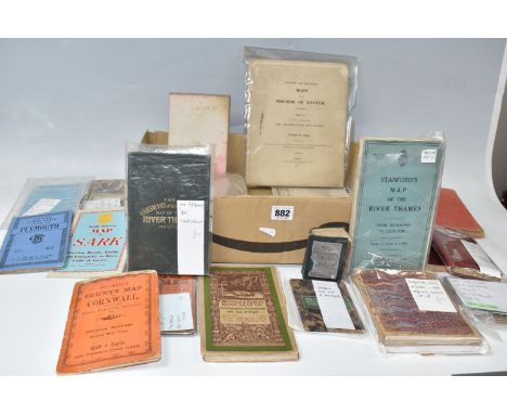
Lot 882
One Box of 19th and early 20th century MAPS, mostly cloth backed and comprising seven Sifton, Praed & Co. Ltd, maps of Hampshire, an Ordnance Survey Road Map of Southampton, Portsmouth and Isle of Wight, a Langley & Belch map of Hampshire, pub. 1817, an Ordnance Survey map of Aldershot and Envs. c1890, a map of London, drawn and engraved expressly for the Post Office Directory 1907, Phillip' Handy-Volume Atlas Of London, 1896, an Ordnance Survey map of London 1896, 'The Circuiteer' Invented by J. Friederichs To Serve As A Guide For Ascertaining Cab Fares, Porterage, etc, etc, No.1 London, a Lett's Pocket Map of London, Stanford's Map Of The River Thames From Richmond To Lechlade, Ravenstein's Oarsman's And Angler's Map Of The River Thames, c1900, The Oarsman's And Angler's Map Of The River Thames, pub. 1885, Crutchley's Road And Railway Map Of The County Of Hertford and A Pocket Map Of The East Sussex Hunt With A List Of Meets and A Table Of Distances, pub. James Dorman, 1882, a Geological Survey of Penzance/St Ives published by The Ordnance Survey, 1909, Crutchley's County Map of Cornwall, showing all the Railways & Names Of Stations, also the Villages, Turnpike Roads, Gentlemens Seats &c.&c, Bacon's Large Scale Plan Of Plymouth, Outline Or Skeleton Maps Of The Diocese Of Exeter Part 1, Containing In Thirteen Plates The Archdeaconry And County Of Cornwall, 1825, Island Of Guernsey, pub. F.B. Guerin, 1888, a Scale Survey Map of Sark, A New Map 0f the County of Gloucester, Divided into Hundreds by R. Rowe 1811
Lot 113
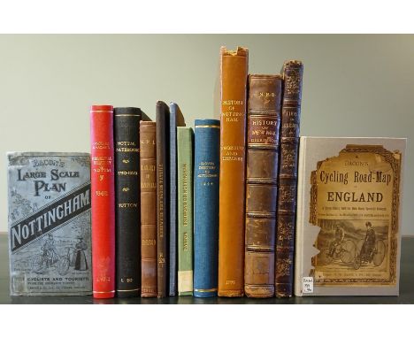
THROSBY, John. The History and Antiquities of...Nottingham, 4to 29.3 x 24cm, re-backed, bookplates for Nottingham Public Libraries Local History department, 24 engravings, library stamp at back of title page, generally bright, occasional spot, some rubbing/bumping at edges, small loss head of spine, Nottingham: sold by Burbage and Stretton, Tupman et al., 1795._ DICKINSON, William. The History of...Newark, 4to 26.6 x 22.5cm, ex-library of Nottingham, internally bright, library stamps at bottom of plates and title-page, corners bumped/rubbed, Newark: M. Hage, 1816._ Together with: Bacon's Large scale plan of Nottingham, c.1890s - Jackson's Plan of Nottingham, 1861 - Darton Environs of Nottingham, c.1830, later casing - Cycling Road-Map of Nottingham, c.1880s, later casing - W. Harrod's History of Mansfield, 1801, later binding, weak spine - Hereward the Saxon Patriot, Architectural Society of Lincoln, hand-coloured genealogy charts - Views of Chester, Derby, Nottingham, 1836, aeg, half-morocco - Glover's Directory of Nottingham 1844, rebound - Nottingham Datebook, 1750-1850, rebound - Lascelles and Hagar's Commercial Directory of Nottingham 1848, rebound - all formerly of Nottingham Public Library local history reference department (12)
Lot 61
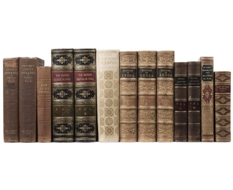
Prinsep (James). Essays on Indian Antiquities, historic, numismatic, and paleographic, to which are added his useful tables..., edited with notes, and additional matter, by Edward Thomas, 2 volumes, 1st edition, London: John Murray, 1858, half-titles, uncoloured lithographed plates of coins, inscriptions etc., original chalk-glazed pale yellow endpapers, original publisher's blindstamped cloth, spines lettered in gilt, rubbed and some light siling, spines a little darkened, together withLady Sale. A Journal of the Disasters in Affghanistan, 1841-2, 1st edition, London: John Murray, 1843, tipped-in printed advertisement for Eyre's Portraits of the Cabul Prisoners at front, folding frontipiece plan of the Cantonments, and single-page map, some light spotting, bookplate of Weston Library to front pastedown, original publisher's blindstamped cloth gilt, lightly rubbed, plus others on India: E. H. Nolan, The Illustrated History of the British Empire in India and the East, from the earliest time to the suppression of the Sepoy Mutiny in 1859, 2 volumes, London: James S. Virtue, circa 1880, contemporary half dark blue calf, gilt decorated spines, Henry Beveridge, A Comprehensive History of India, Civil, Military and Social... including an outline of the early history of Hindoostan, 3 volumes, London: Blackie and Son, 1862, bound in contemporay gilt decorated full calf, A. H. Hallam Murray, The High-Road of Empire, Water-Colour and Pen-and-Ink Sketches in India, London: John Murray, 1905, limited deluxe edition of 150 numbered copies, Earl Roberts of Kandahar, Forty-One Years in India, 1911, Reginald Hever, Narrative of a Journey through the upper provinces of India, 2nd edition, volumes I and III (of 3) only, 1828, and Mrs Colonel Elwood, Narrative of a Journey overland from England, by the continent of Europe, Egypt, and the Red sea to India, volume II only, 1830, some bound in contemporary leather bindings, 8vo/large 8voQTY: (13)
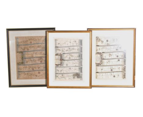
![Jenner (Thomas). [A Book of the Names of all Parishes, Market Towns..., 1657], list of Highways and 37 mileage tables with 't](https://cdn.globalauctionplatform.com/dbf67710-f959-4453-bf24-b2b50118f665/d564ceef-8a4d-4094-8975-b2d1010b9178/468x382.jpg)
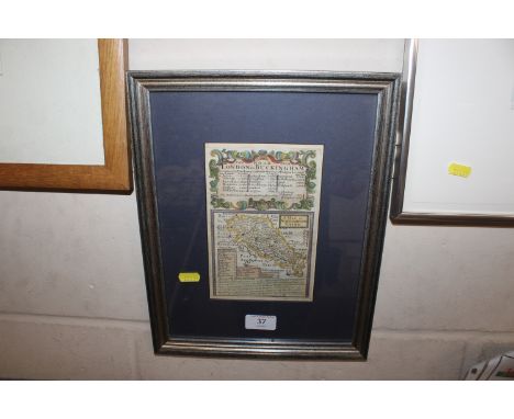
Lot 107
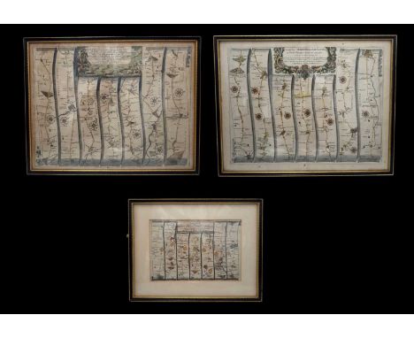
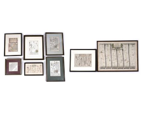
Jenner (Thomas). [A Book of the Names of all Parishes, Market Towns..., 1657], list of Highways and 37 mileage tables with 'thumbnail maps' engraved by Jacob van Langeren, each excised, trimmed and laid on later paper, the three larger maps (England & Wales, Wales and Yorkshire) with old folds, the maps of Wales & Yorkshire with old worm tracks, the maps of Durham and Sussex, torn and crudely repaired, book plate of Heber Mardon (founder - along with his father - of Marden Son and Hall, printers of Bath) also Dr Douglas G. Bancroft, early 20th century half morocco gilt, spine faded, a little rubbed, 4to, together with Leigh (Samuel). Leigh's New Pocket Road Book of England and Wales and part of Scotland..., 1837, frontispiece of the price of posting, additional decorative half-title and preface, 55 uncoloured engraved maps, index and publisher's advertisement bound at rear, upper hinge partially cracked, contemporary morocco gilt, re-backed but retaining the original spine, bumped and a little worn, 12mo, with Lewis (Samuel). A Topographical Dictionary of Wales..., 2 volumes, 1834, preface and list of subscribers, uncoloured engraved folding map by J & C Walker of Wales and 12 county maps, very slight spotting, later endpapers, contemporary cloth gilt, re-backed, 4to QTY: (4)NOTE:Sold as a collection of maps, not subject to return.
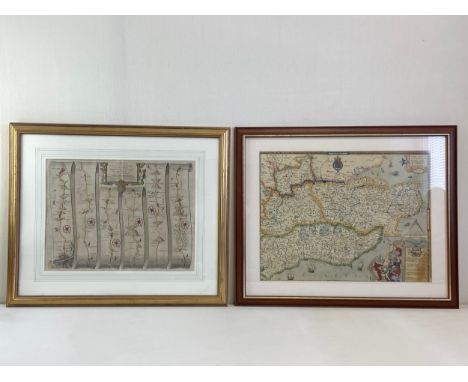
Lot 195
Maps and Cartographic Ephemera. A collection of approximately 50 items, 19th & 20th century, including folding maps, advertisements and catalogues, portraits of cartographers and explorers, 2 volumes of the Map Collector's Circle (11th volume numbers 104 & 105), on portraits of geographers and cartographers, Ordnance Survey, a cartographic jigsaw puzzle, and a few topographical views of London (each view with a literary or a cartographic emphasis), together with McCall (Taylor). Behind Us, Bocaccio Books, Stockbridge: 1970, hand-coloured illustrations throughout, limited signed edition 230/300, marbled endpapers, publisher's morocco with gilt design to the upper siding, spine sun-toned, contained in a contemporary cloth slipcase, small folio, with Blaeu (Johannes). Rutlandia Comitatus Rutland Shire, Amsterdam: [1645 - 61], engraved map with bright contemporary hand-colouring, large margins, 385 x 500 mm, Latin text on verso, together with Regiones Inundatae in sinibus comitatus Norfolciae, Suffolcia, Cantabrigiae, Huntingtoniae, Northamtoniae et Lincolniae, Amsterdam: circa 1650, engraved map with contemporary hand-colouring, slight creasing, 440 x 545 mm, no text on verso, Kitchin (Thomas & Jefferys Thomas). A Map of Surrey, circa 1787, engraved map with contemporary hand-colouring, descriptive text below the map, 185 x 145 mm, together with Moule (Thomas). Surrey, circa 1848, uncoloured engraved map, unusually large margins, central fold strengthened on verso, 220 x 270 mm, with Collins (H. G.). The British Gazetteer. Surrey, circa 1850, hand-coloured engraved map, old folds, 355 x 430 mm, plus Mogg (E.). London to Southampton measured from Hyde Park, 1814, strip road map with contemporary hand-colouring (the map commences at London and ends at Hounslow Heath), 235 x 165 mm, and three copies of a hand-coloured view of Twickenham, originally published in Harrison's 'History of London', each 175 x 290 mmQTY: (approx.60)
Lot 141
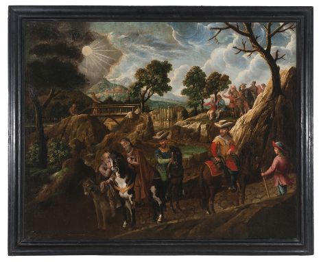
Melchor Pérez Holguín (Cochabamba, Bolivia, 1660 - Potosí, 1732)"The First Journey of Saint James the Greater to Hispania"Oil on canvas.99 x 124 cm. Beautiful painting of great historical and religious relevance, as it shows the first of James' journeys to Hispania, which left a lasting legacy in the region. This trip took place in the first century A.D. According to tradition, James was sent to Spain as one of Jesus' apostles to spread Christianity in the region. After the death of Christ, a passionate and impetuous James was part of the initial group of the early church in Jerusalem. In his evangelizing work he was awarded, according to medieval traditions, the Spanish peninsular territory, specifically the northwestern region, then known as Gallaecia. Some theories suggest that the current patron saint of Spain arrived in the northern lands via the uninhabited coast of Portugal. Others, however, trace his way through the Ebro valley and the Cantabrian Roman road. There are even those who claim that Santiago reached the peninsula by the current Cartagena, from where he started his journey to the western corner of the map.During his stay, it is believed that he performed numerous miracles and converted many people to Christianity.This journey of Santiago was of great importance for the history of Christianity in the Iberian Peninsula. His presence contributed to the expansion of Christianity in the region and laid the foundations for the subsequent evangelization of the peninsula.We say that this was James' first trip to Spain, since the second occurred centuries after his death. According to tradition, after his death in Jerusalem, his remains were taken to Hispania by his disciples. It is believed that they were buried in a place that would later become the city of Santiago de Compostela. That transfer of remains had a great impact on the region. His tomb became an important place of pilgrimage and attracted thousands of the faithful from all over Europe. The Camino de Santiago, a pilgrimage route that runs throughout the Iberian Peninsula, developed around his tomb and became one of the most important pilgrimage routes in the world.In an idyllic landscape, with rich and abundant vegetation, we can contemplate a pilgrimage path that circles the river -perhaps the Ebro River-, with a bridge crossing it. The pilgrims have serene faces, full of devotion, kindness and smiles, marked by the joy of the moment. They travel on horseback and on foot, and there is a group resting above, contemplating the temple they are approaching, surrounded by cypress trees. One stands out, James, also known in Spain as Santiago, mounted on an imposing black and white horse, the only one who, with his deep and penetrating gaze, looks directly at the viewer. The Saint stops or is stopped by another pilgrim, who rides his donkey, and both experience a spiritual and deep encounter, reflected in their faces and gestures. Their expressions are serene, with their hands intertwined. The one on the donkey kisses the hand of the saint with reverence and devotion, aware of the spiritual power of this miraculous encounter. Both the Apostle and he have their hats removed, as a sign of respect, humility and spiritual reverence.James' journey to Galicia symbolizes the spiritual connection between East and West, becoming a cultural and religious bridge that would mark the history of Spain. As for the artist, we believe this canvas was painted by Melchor Pérez Holguín, one of the most important painters of the colonial mestizo baroque, of what was called the Potosí School, which developed in the years 1700 - 1790. Tenebrism and the influence of Zurbarán were characteristic. Holguin’s work is dominated by the many commissions carried out for the Franciscans and the Dominicans.As Suzanne L. Stratton-Pruitt indicates, despite the fact that Holguín of course knew the Cuzcan art that was widespread and stylistically of great influence in Upper Peru, his work was very personal, and is somewhat removed from that style, although it adopts some common elements as the painting of Cuzco. Likewise, the serenity reflected in the faces of his characters is characteristic of Holguín, as we can see in the work we offer.
Lot 245
17th and 18th Century strip and travel maps of Northumberland, to include: John Ogilby, "The Road from Tynmouth to Carlisle"; Emanuel Bowen strip map, Tynemouth to Carlisle (x2); John Ogilby "The Continuation of the Road from London to Barwick"; a map of Northumberland published by Thomas Read; Thomas Jenner Northumberland mileage chart; and two others
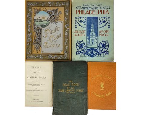
Lot 184
PACIFIC COAST ALBUM. Published by C.P. Heininger, (c. 1890). Leporello album w. 24 pp. w. illustr. Or. pictorial cl. -- THE STRANGER'S Complete Guide; or, Liverpool as it is; being a manual for the resident and visitor. New. ed. 1854. W. large-fold. map of Liverpool pasted in on paste down. 12°. Ocl. (W. libr. stamps). -- DRAKES'S ROAD BOOK of the grand junction railway, from Liverpool & Manchester to Birmingham. (N.d., c. 1830). W. large fold. map & 4 engr. advertising plates (1 fold.). Sm-8°. Ocl. (Front side and map loose, tear in map (but complete), w. libr. stamps). -- And 2 o. (5).
Lot 590
A QUANTITY OF PICTURES AND PRINTS ETC, to include a Albert Lawrence Hammonds charcoal sketch of a steam locomotive in New Street Station, approximate size 26cm x 37cm, Tom Maxwell dry point etching of Old West Kirk in Greenock, Henry G Walker etchings with colours, a pastel drawing of Elephants signed P. Goode, a watercolour of a feeding Elephant signed Keith Hill - some damage, an indistinctly signed limited edition print of Pawneese race horse, Tristram Hillierprint 'The Blue Cart', Snow Hill Station print by Robert K. Calvert, David Hockney poster print 'Pool with two figures', George Romney Mezzotint print signed by the engraver, four reproduction Francis Wheatley prints, a John Owen and Emanuel Bowen road map 'Ashburton to Plymouth', unframed watercolour of a Japanese female figure, an engraving of 'East View of Birmingham in Warwickshire', a Joy Devision poster 'The Ideal Beginning', Levis 501 poster, assorted other prints, two glazed display frames etc

Lot 224
Genuine Tiger with Ford 289ci five bolt enginePrepared for classic rallies and campaigned with great successSupplied with FIVA ID card granted in 2010 and Certificate of AuthenticityRally ready example but still wonderful as a fast road carInspired by the AC Cobra, which was effectively the British AC Ace sportscar and powered by the large American Ford 4.2 litre, V8, the Sunbeam Tiger first saw the light of day in 1964. Based upon the Rootes Group, Sunbeam Alpine, the Tiger, with the Ford power plant slotted into the engine bay, became what is surely one of motoring's true 'wolf in sheep's clothing'. With stunning performance due not only to the mighty V8 but also thanks to the lightweight Alpine shell, Tigers are sought-after for collectors and enthusiasts.This handsome Sunbeam Tiger is finished in Mediterranean Blue with black trim, it was built by Jensen in 1965 and first registered in 1967. The car was purchased by the previous owner in December 2008 and was described as a near concours example. The previous owner then set about converting the Tiger into full historic rally specification with the emphasis on driveability and reliability. The car was then extensively campaigned throughout the UK and Europe in many prestigious events and, we are informed, it has never failed to finish a rally due to mechanical issues. Importantly, the car itself is a genuine Sunbeam Tiger with a Certificate of Authenticity from the STOA USA and STOC UK and is a well-known car in classic rally circles and to the STOC.Supplied with an astonishing history file from 1965 to the present day, it encapsulates almost every MoT test certificate. Also contained within the history file are the original bills of sale from 1972 and 2008, the green logbook dated 1967, the original stamped service book dated 1967, extensive paper and photographic history, receipts from the 1980s to 2008 prior to the rally conversion, extensive current paperwork and photographic history including all invoices and an engine rebuild from 2009 to 2019, a 2010 FIVA ID card which expired in 2020, current wiring diagram for all fuses and relays and finally the original owner's handbook and workshop manual.This example could, with relative ease, be returned to fast road specification with the benefit of sublime handling for a Tiger, long range fuel tank and exceptional performance. This a very exceptional Sunbeam Tiger in amazing condition and with perhaps the best history found on such a car, the history file is truly vast. The previous owner lavished in excess of £40,000 on the vehicle since 2008, and our vendor purchased the car in 2022, managing to attend many events and shows since then. It now represents a unique opportunity to own a very special car which would be equally as valuable for historic rallying as it would be presented as a fast road original Tiger.The extensive rally modifications carried out include:High-capacity aluminium radiatorUprated front anti roll barAutomatic electric fan with manual overrideTwin Facet fuel pumps with fuel filtersTwin coils under the bonnetUprated alternatorFull engine rebuild with modern USA sourced heads, pistons, rings etc.Rebuilt Koni adjustable shocksQuick steering rackDiscreetly installed variable electric power steering rackFly-off handbrakeHydraulic handbrake easily deactivated when rally regulations do not allow itLong range flat fuel tank for maximum boot storage capacity, approx 18 gallonsUprated springs front and rear poly bushedPanhard rod with poly bushed bearings14” alloy Minilite wheelsCompetition clutch from USACompetition front pads and rear brake shoesOriginal front calipers and rear drums to comply with rally regulationsFuel coolerHurst shifterSalisbury LSD with rebuilt lower ratio diff 3:54 (original 2:88 diff too high for quick auto test)Original four speed Ford top loader gearbox in excellent working orderCompetition seats with new 3” blue harnessesFull respray in correct Mediterranean BlueBolt in roll hoop painted in Mediterranean blue with many rally stickersNew hoodFire extinguisher with fitted cageBrantz BR32 rally timer with operating instructionsBrantz Internation Pro trip meter with operating instructionsFull sump guardCibie driving lamps with adjustable staysPeriod Lucas reversing light and two integral original fit Tiger reversing lights, all switched by engaging reverse gearStainless steel luggage rackMoto-Lita steering wheelAir hornsHigh performance water pumpSports exhaust that meets noise regulations, fully secured with chains and skid platesTowing eyes, front and rearHeat wrapped headersAnti tramp barsBalanced crankshaft and fly wheelTwo digital stopwatches dash mounted, plot light, alloy under dash navigators road book tray, various map pockets, centre armrest storage.Consigned by Fraser Smith GENUINE TIGER WITH FORD 289CI FIVE BOLT ENGINEPREPARED FOR CLASSIC RALLIES AND CAMPAIGNED WITH GREAT SUCCESSSUPPLIED WITH FIVA ID CARD GRANTED IN 2010 AND CERTIFICATE OF AUTHENTICITYRALLY READY EXAMPLE BUT STILL WONDERFUL AS A FAST ROAD CAR
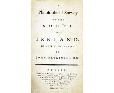
Lot 5
Irish Travel: Campbell - A Philosophical Survey of the South of Ireland, in a Series of Letters to John Watckisnon M.D., Dublin 1778. First Edn., 6 engd. plts. (2 fold.), recent hf. mor.; Stark (A.G.) The South of Ireland in 1850, D. 185, First Edn., add. engd. title, text illus. cloth, dam.; The Travellers New Guide Through Ireland, Lond. 1819. Engd. frontis fold. map, 1 fold. map of Killarney, & many engd. road maps, cont. hf. mor. good. (3)
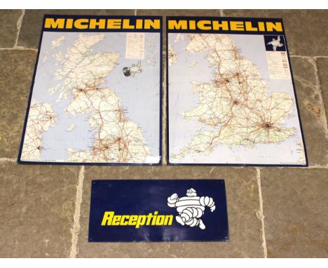
Lot 636
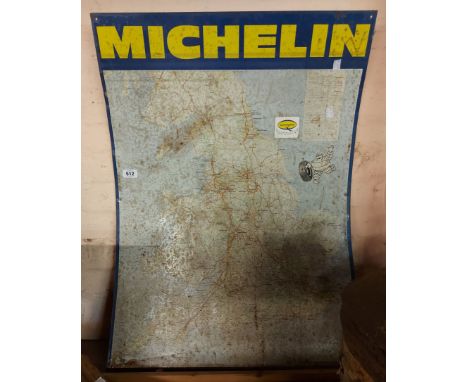
A Michelin road map metal sign, for England and Wales, 86cm x 62cm, a second Michelin road map sign for North England and Scotland, 86cm x 62cm, along with a Michelin 'Reception' sign, 56cm x 26cm, all signs applied with a Bibendum logo (Michelin man) (3)Condition reportMinor abrasions and scratches to the reception sign, please see additional images.Minor marks to the road maps, although no major faults or damage.
Lot 88
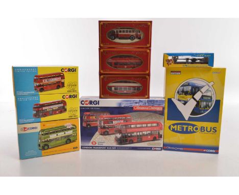
Corgi and ABC Model 1:76 Scale Vintage and Modern Public Transport Models (9), all boxed, ABC Model, TRA 5004 Alexander Bodied double deck bus London Northern in red livery route 234 TRA 5003 Alexander double deck bus London Buses in red/white livery route 140, TRA 5101 1926 Leyland Lion Southport Corp Tramways, in red/white livery, CH7001 1926 Leyland Lion chassis (box P), Corgi, AN40814 Bristol Lodekka Lincolnshire Road Car in green livery, with display plinth, map and certificate, Corgi 60th Anniversary models, OM36310 6 Routemaster OM46613 New Routemaster both in LT red, OM49904 LT three model set, trolleybus, Routemaster, New Routemaster, OM99172 Metrobus two model set, includes Dennis Trident and Dennis Dart both in yellow/blue livery, G-E, boxes P-E, (9)
Lot 502
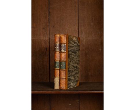
Robertson (Archibald) A Topographical Survey of the Great Road from London to Bath and Bristol, London: The Author, 1792, two volumes, 8vo, 19th Century half calf and marbled boards, title and volume labels, 65 plates, 10 fold-out maps and one single page map (2)A Gloucestershire book collector
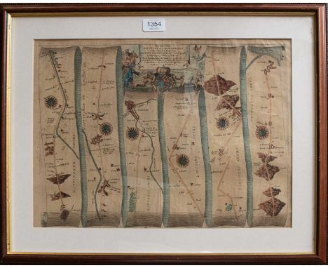
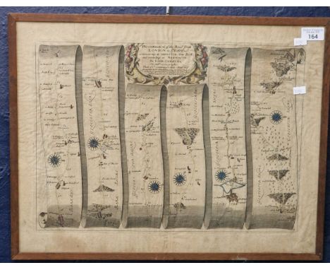
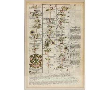
![After John Ogilby,The Road from London to Darby [sic],hand coloured map,32x43cm.](https://cdn.globalauctionplatform.com/1b55b801-a8df-4baa-9eb2-b29900e0cc4c/88e282e1-aa0a-4be1-a7b1-b2c9010eb0f7/468x382.jpg)
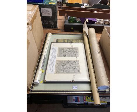
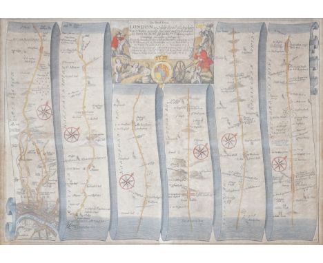
Lot 130
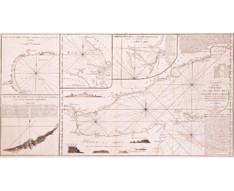
Sea charts. 1798 A Chart of the Entrance of the Red Sea between the Coast of Arabia, ascertained by the Observations of Lieut. George Lewis in 1762; and the Opposite Coast of Africa with the Isle of Socotra. London: published by Laurie & Whittle, 12th Oct 1798. Engraved map, some offsetting, tape repairs to centrefold. Depicting directions for going into Mocha Road by Captain Richardson, carious inset plansincl. Plan of the Watering Place on the Island of Socotra. A rare maritime chart of the Red Sea.Measures approx. 93cm x 64cm.
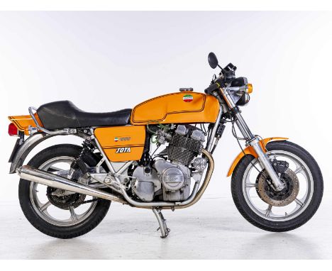
Lot 259
1981 Laverda 981cc Jota 180Registration no. VVX 423WFrame no. LAV.1000/3CL*7074*Engine no. 1000*7074*Blessed with one of the most evocative names in motorcycling history, the Jota put Laverda on the map. Its direct progenitor was the tuned version of the Italian firm's 3C triple - the 3C(E) - developed for production racing by the UK importer, Slater Brothers. The production Jota was both more highly tuned and quicker, its 140mph maximum making it the world's fastest road-going production motorcycle when introduced for 1976. In 1982 a heavily revised version arrived, featuring a 120-degree crankshaft that made for a more even firing order than the original's 180-degree 'flat' crank. Today, the Jota is one of the most collectible of Italian classics, particularly the first '180' version. Currently displaying a total of 42,072 miles on the odometer (at the time of cataloguing/photography), this Jota was purchased by our vendor in 2016. The machine has been kept dry stored and was last started in the summer of 2024. A Laverda Scozia ignition system and charging kit was fitted in 2023 (receipt on file). Following a period of inactivity, this motorcycle will require recommissioning to a greater or lesser extent before returning to the road and thus is sold strictly as viewed. Accompanying documents include a current V5C, some old MoTs (most recent expired 2015), and the aforementioned Laverda Scozia receipts. It should be noted that the 'LAV.1000/3CL' frame and '1000' engine prefixes have been omitted from the V5C. Offered with keyFootnotes:All lots are sold 'as is/where is' and Bidders must satisfy themselves as to the provenance, condition, age, completeness and originality prior to bidding.Please see the Auction Information and Guide for Buyers at the top of the main sale page, for bidders' obligations. The Spring Stafford SaleREQUEST A TRANSPORT QUOTEPlease click the link to request a transport quote from our recommended transport company, Moving Motorcycles.To request a UK or European shipping quote - Moving MotorcyclesTo request an International shipping quote - ShippioThis Lot will be auctioned on Sunday 27 April, with the auction starting at 11am GMT.For further information on this lot please visit Bonhams.com
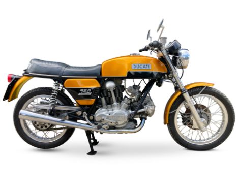
Lot 247
The Andy Chapman Collection - Part II1974 Ducati 750 GTRegistration no. PPV 75MFrame no. DM750S*756088*Engine no. 756151 DM750•Present ownership since 2019•7,212 miles recorded•Requires recommissioning Designed by the legendary Fabio Taglioni, Ducati's first road-going v-twin - the 750 GT - arrived in 1971. Lacking the resources of larger Far Eastern rivals, Ducati had made the most of what it already possessed to create one of the all-time great post-war motorcycles. A 90-degree vee, the engine looked like two of the Bologna firm's bevel-drive overhead-cam singles on a common crankcase (which in essence it was) though the coil valve springs represented a departure from Ducati's traditional hairpins. The 90-degree layout made for exceptional smoothness and a lengthy wheelbase, a handicap more apparent than real that failed to stop the fine-handling Ducati's notching up a succession of wins in Formula 750 events, commencing with Paul Smart's famous victory at Imola in April 1972. Without question, it was Smart's Imola win that really put Ducati's new v-twin on the map. It was a particularly sweet occasion for hitherto un-fancied Ducati, as the Bologna factory defeated not only the race-proven Triumph Tridents of Percy Tait, John Cooper and Ray Pickrell, but also the works 750 MV Agusta of Giacomo Agostini. Previously registered/used overseas, this example was first registered in the UK on 10th February 2011 and has belonged to the current vendor since 2019. The machine displays a total of 7,212 miles on the odometer (at the time of cataloguing/photography) but nothing else is known of its history. Following a period of inactivity, this motorcycle will require re-commissioning to a greater or lesser extent, or possibly more extensive restoration, before returning to the road and thus is sold strictly as viewed. The Ducati is offered with a V5C Registration Certificate, the 2019 purchase invoice from Motorcycle Service Centre, and expired MoTs (most recent expired January 2019). It should be noted that the V5C omits the 'DM750' prefix/suffix and the HPI records the previous colour as red/black.Offered with keyFootnotes:All lots are sold 'as is/where is' and Bidders must satisfy themselves as to the provenance, condition, age, completeness and originality prior to bidding.Please see the Auction Information and Guide for Buyers at the top of the main sale page, for bidders' obligations. The Spring Stafford SaleREQUEST A TRANSPORT QUOTEPlease click the link to request a transport quote from our recommended transport company, Moving Motorcycles.To request a UK or European shipping quote - Moving MotorcyclesTo request an International shipping quote - ShippioThis Lot will be auctioned on Sunday 27 April, with the auction starting at 11am GMT.For further information on this lot please visit Bonhams.com
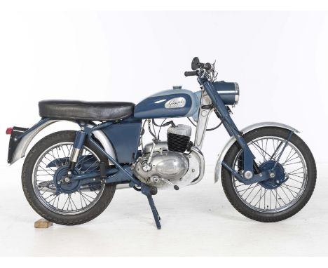
Lot 227
1960 Greeves 250cc 25DB Sports TwinRegistration no. TSL 187Frame no. 603083Engine no. 950A 8593Greeves' unorthodox trademarks of a cast beam 'down-tube' and rubber-in-torsion leading-link fork proved adaptable to almost all forms of motorcycle from humble commuter to clubman's road-racer, but it was the firm's off-road products which really put it on the map, generating valuable publicity that helped sell the roadsters. Greeves first twin-cylinder roadsters of the mid-1950s used the Anzani engine and it was not until 1957 that the first Villiers-engined twin - the 25D Fleetwing – appeared, powered by the four-speed Villiers 249cc 2T engine. For 1959 the 25D was renamed Sports Twin, its designation changing to 25DB. It cost £199 15s, with the scrambles models' 'paddle fin' hubs an optional extra at £4 10s. For 1961 the 250 and 350 roadster twins were updated with a new scrambler-based frame with the one-piece rear sub-frame, becoming the 25DC and 32DC respectively.Not much is known of this restored Sports Twin and its previous history, restored by the vendors late father and not used for over a year, it will need recommissioning before returning to the road however the engine turns over and has been dry stored since last use. Offered with a V5C and a Villiers workshop manual.Key not requiredFootnotes:All lots are sold 'as is/where is' and Bidders must satisfy themselves as to the provenance, condition, age, completeness and originality prior to bidding.Please see the Auction Information and Guide for Buyers at the top of the main sale page, for bidders' obligations. The Spring Stafford SaleREQUEST A TRANSPORT QUOTEPlease click the link to request a transport quote from our recommended transport company, Moving Motorcycles.To request a UK or European shipping quote - Moving MotorcyclesTo request an International shipping quote - ShippioThis Lot will be auctioned on Sunday 27 April, with the auction starting at 11am GMT.Lot to be sold without reserve.For further information on this lot please visit Bonhams.com
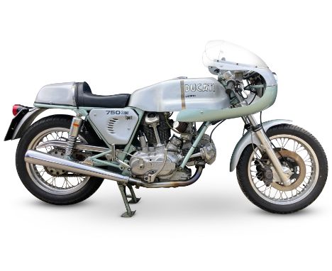
Lot 248
The Andy Chapman Collection - Part IIc.1974 Ducati '750SS Replica'Registration no. LGT 149NFrame no. DM750S 755327 (see text)Engine no. 751138 DM750 (see text)•Based on the 750GT•Formerly resident in Denmark•UK-registered since 2011•Present ownership since 2019It was, without question, Paul Smart's famous victory at Imola in April 1972 that really put Ducati's new v-twin on the map. It was a particularly sweet occasion for hitherto unfancied Ducati, as the Bologna factory defeated not only the race-proven Triumph Tridents of Percy Tait, John Cooper and Ray Pickrell, but also the works 750 MV Agusta of Giacomo Agostini. With such an outstanding pedigree, the 750SS was a natural choice for racing's Superbike category, and later on proved highly competitive in 'Battle of the Twins' (BOTT) racing in the USA and Europe.Smart's bike was based on the 750GT roadster introduced that same year. The racer's cycle parts remained close to stock - even the centre stand lugs were retained! - merely being up-rated with triple Lockheed disc brakes, while the engine gained desmodromic cylinder heads, high-compression pistons and stronger con-rods. When the definitive production version - the 750SS - appeared in 1974 it differed little in overall conception from the Imola '72 bikes, among the most obvious external differences being the adoption of a centre-axle fork and Brembo front brakes. The big 'Imola' fuel tank and humped racing seat both featured on the road bike, which wore a cockpit faring rather than the racer's fuller streamlining. Only 401 examples of the original 'round case' version were built before being superseded by the less desirable 'square case' model for 1975. Today the landmark '74 750SS is one of the most sought-after of all Ducati's.As is so often the case with rare and exotic vehicles, the scarcity of genuine survivors has led to the creation of replicas such as that offered here, which uses the correct 'round case' type of engine. The frame appears to be from a circa 1974 750GT and the engine from a circa 1972 750GT, while other notable features include Lockheed front brake callipers and Conti silencers.Our vendor purchased the Ducati in 2019. Previous owner Mr Dave Cowpe had bought the Ducati from a dealer in Denmark in 2011. The machine comes with a copy of the seller's email listing its specification (perusal essential); however, it should be noted that it has not proved possible to verify any of the claims made. Accordingly, prospective purchasers must satisfy themselves with regard to the nature, authenticity and condition of this motorcycle's constituent parts prior to bidding.Accompanying documents also include sundry bills; assorted correspondence; a current V5C document; and a copy of Real Classic magazine's January 2012 article on this machine (when it was owned by Dave Cowpe). Following a period of inactivity, this motorcycle will require re-commissioning to a greater or lesser extent, or possibly more extensive restoration, before returning to the road and thus is sold strictly as viewed (the engine turns over with compression).Offered with keyFootnotes:All lots are sold 'as is/where is' and Bidders must satisfy themselves as to the provenance, condition, age, completeness and originality prior to bidding.Please see the Auction Information and Guide for Buyers at the top of the main sale page, for bidders' obligations. The Spring Stafford SaleREQUEST A TRANSPORT QUOTEPlease click the link to request a transport quote from our recommended transport company, Moving Motorcycles.To request a UK or European shipping quote - Moving MotorcyclesTo request an International shipping quote - ShippioThis Lot will be auctioned on Sunday 27 April, with the auction starting at 11am GMT.For further information on this lot please visit Bonhams.com
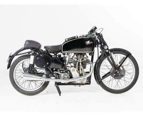
Lot 297
From the estate of the late Geoffrey St John1939 Velocette 348cc KTT Mark VIIIRegistration no. GWB 943Frame no. SF31Engine no. KTT 806 Gearbox no. 7-5252•Iconic and beautiful Mark VIII KTT•Long-term ownership of over 45 years•A rare matching numbers machine•One of the few sought after pre-war Mark VIIIsThe Velocette Mark VIII KTT is widely regarded as one of the most beautiful motorcycles ever made. It was introduced at the 1938 Earls Court Show, and was effectively a production version of Stanley Woods' works machine which had won the Junior TT only a few months before. That victory was repeated in 1939, 1947, 1948 and 1949. These wins were of course by the factory machines, but in the hands of privateer riders the Mark VIII production racer was hugely successful in its own right. 25 of the 35 bikes which finished the 1939 Junior were Velocettes, albeit some of these would have been the preceding rigid framed mark VII model. It was also an exceptional demonstration of high-speed reliability: out of the 32 Velocettes which started the 1939 race, only 7 retired. By comparison, of the 15 Nortons which started, there were 9 DNFs.Fewer than 50 Mark VIIIs were manufactured before the war, and a further 189 afterwards. In his excellent book 'Classic Motorcycles' the highly respected motorcycle journalist, Vic Willoughby, who raced them both pre- and post-war, observed: 'Regrettably, some of the post-war Mark VIIIs, though supposedly identical, were inferior in workmanship and performance to the pe-war ones............But these post-war problems detracted not one whit from the brilliance of the original design. So far as production models were concerned, the Mark VIII KTT typified the initiative, superb engineering and soundly based confidence that put Velocette on the map in their golden years....'The Veloce despatch records indicate that KTT806's frame, engine, and gearbox are the original matching components. It was despatched to Henstocks of Mansfield on 27.4.39 for its first owner J. G. Wilson – this was J. Gordon Wilson of Gordon Tools in Sheffield, the highly respected tool manufacturers. Many of the pre-war Mark VIIIs were raced in the 1939 Junior TT, but KTT806 was not among them. However, Ron Gibson, Gordon Wilson's work colleague and close friend, also ordered a Mark VIII. This was KTT820 which Ron rode to 33rd place. We don't know whether Gordon Wilson was on the Isle of Man to see the 1939 race, but it seems very likely that he would have been. Gordon Wilson registered 806 for road use on 14th July 1939, the registration number being GWB 943. Road registrations on competition motorcycles are comparatively rare, but when they still exist, old style logbooks are invaluable when it comes to checking a bike's history. In this case the original logbook must have been lost in the early post-war years, but fortunately the bike comes with a replacement logbook issued by London County Council on 16th May 1950. Some of the information recorded on this logbook goes back to 1939, but it is stamped 'Previous owners omitted to save space' - therefore Gordon Wilson's name does not appear. We don't know when Gordon Wilson sold 806, but the first recorded keeper on this replacement logbook is Charles Rene Bruguiere of London SE26. Manx iMuseum records indicate that Charlie Bruguiere raced in the 1948 Junior TT, retiring for unknown reasons (it should be noted that in these Manx records his name is spelt Brugiere). Thanks to Hedley Cox, one of the post-war Velocette factory race mechanics, we know that the bike that Charlie rode was KTT806. In his 'KTT Engine Notes' (the list of Mark VIII KTTs on which he had worked), Hedley's very first entry reads: 'KTT 806. Owned by Brugiere. Ridden by him in 1948 TT no. 48'. The Manx records indicate that in 1948 and 1949 Charlie Bruguiere also raced with some success in Belgium, and, including second place in the 350 and fifth in the 500 class on a 350 Velocette at Chimay in 1949. We cannot be sure that this was achieved on 806, but it seems reasonably likely given that the bike was still in his possession at that time. Charlie returned to the Island in 1951, but this time on an AJS, presumably a 7R. The logbook indicates that 806 passed to its next owner, Ross Westmacott Porter of Spalding, in 1954. In October 1955 Charlie Bruguiere emigrated to Australia, quoting his occupation as 'racing motorcyclist'. KTT806 had six further owners before it was purchased by the late Geoffrey St John who, according to the accompanying green continuation logbook, registered his ownership on 27.6.1972. He owned several Velocettes over the years, but he kept this one for the rest of his life: a long-term ownership of over 45 years. In the earlier years of his ownership it was raced in various events by local Gloucestershire rider George Ridgeon.The motorcycle is accompanied by a V5C, the aforementioned buff and green logbooks, and a substantial document file which includes correspondence, invoices, price lists, and a couple of photos of it being raced by George Ridgeon. Judging by the accompanying paperwork, Geoffrey St John did a fair amount of work on the Velo through the 1970s. Later, around 2000-2001, he had a very thorough cosmetic restoration carried out by Frank Chapman of Minster Lovell. A photographic record of this restoration is supplied. This is a rare opportunity to acquire an extremely desirable matching numbers pre-war Mark VIII KTT. Recommissioning will be required following a period of storage. Prospective bidders should satisfy themselves as to the motorcycle's completeness and mechanical condition prior to bidding. Sold strictly as viewed.Key not requiredFootnotes:All lots are sold 'as is/where is' and Bidders must satisfy themselves as to the provenance, condition, age, completeness and originality prior to bidding.Please see the Auction Information and Guide for Buyers at the top of the main sale page, for bidders' obligations. The Spring Stafford SaleREQUEST A TRANSPORT QUOTEPlease click the link to request a transport quote from our recommended transport company, Moving Motorcycles.To request a UK or European shipping quote - Moving MotorcyclesTo request an International shipping quote - ShippioThis Lot will be auctioned on Sunday 27 April, with the auction starting at 11am GMT.For further information on this lot please visit Bonhams.com
Lot 1137
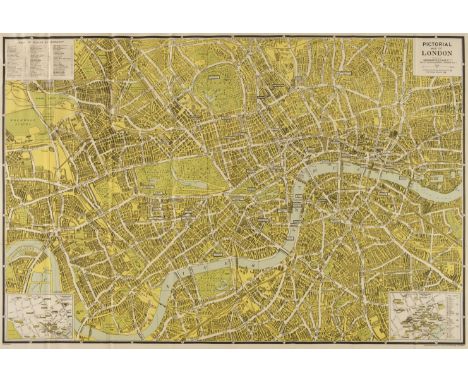
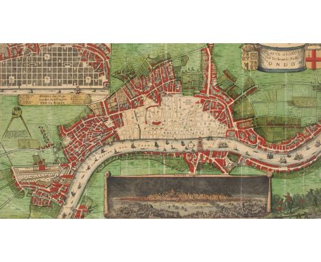
Großbritannien - - Platte Grondt der Verbrannte Stadt London. 2. Hälfte 17. Jahrhundert. Kolorierte Radierung. 53 x 29 cm (63 x 39 cm). Ganzflächig aufgezogen auf Pappe und unter Passepartout montiert. Die kolorierte Karte des barocken Londons zeigt durch seine rot gefärbten Flächen im Stadtplan die großflächige Zerstörung der Stadt nach dem Großen Brand im September des Jahres 1666. Am unteren Rand der Karte zeigt ein Panorama die Stadt während des Feuers, welches bis zu 80 Prozent der Häuser innerhalb der Stadtmauern zerstörte. Die obere linke Ecke füllt ein Vorschlag für ein neues Straßennetz Londons. Da nach dem Brand ein großer Teil der Stadt nun brach lag, gab es einige Vorschläge für ein neues rechtwinkliges Straßennetz mit geplanten Schmuckplätzen. - Knickspuren, Randläsuren, minimal fleckig. Passepartout mit Einriss. Insgesamt gut erhaltene Karte in leuchtendem Kolorit. 2nd half of the 17th century. Coloured etching. Mounted over the entire surface on cardboard and mounted under passepartout. - The coloured map of Baroque London shows the extensive destruction of the city after the Great Fire in September 1666. At the lower edge of the map, a panorama shows the city during the fire, which destroyed up to 80 percent of the houses within the city walls. The top left-hand corner is filled with a proposal for a new road network in London. As a large part of the city now lay derelict after the fire, there were several proposals for a new rectangular street network with planned decorative squares. - Creases, marginal tears, minimally stained. Tear in passepartout. Overall well-preserved map in bright colouring.
-
4033 item(s)/page