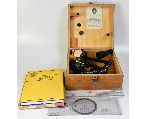
We found 4840 price guide item(s) matching your search
There are 4840 lots that match your search criteria. Subscribe now to get instant access to the full price guide service.
Click here to subscribe- List
- Grid
-
4840 item(s)/page

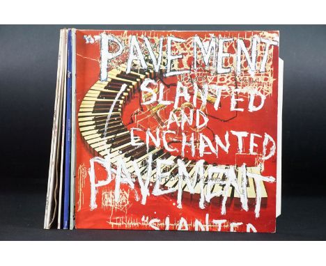
Lot 152
Vinyl - 4 Pavement LP’s and 3 x 12” to include: Slanted And Enchanted (Big Cat – ABB34, UKL 1992 with insert), Crooked Rain Crooked Rain (Big Cat – Abb56, UK 1994 with limited edition 7” single), Wowee Zowee (Big Cat – abb84, UKL 1995 double LP, one LP is single sided), Westing (By Musket And Sextant) (Big Cat – ABB 40, UK 1993 with insert), Watery, Domestic (Big Cat – ABB38P, UK 1992 picture disc 12”), Trigger Cut Plus 2 (Big Cat – ABB35T UK 1992 12”), Gold Soundz (Big Cat – ABB70T, UK 1994 12”). Condition VG+ overall
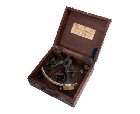
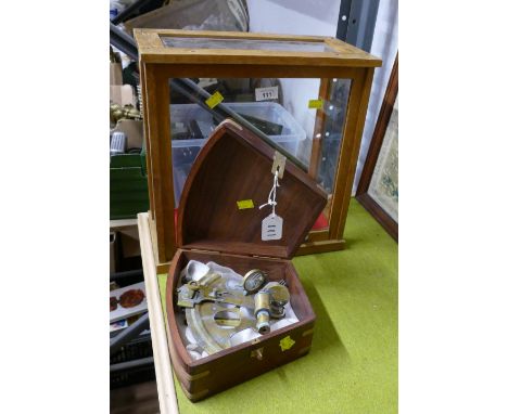
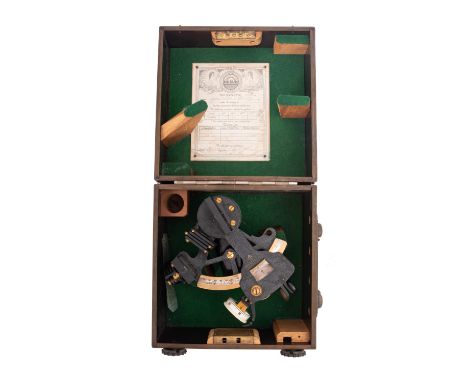
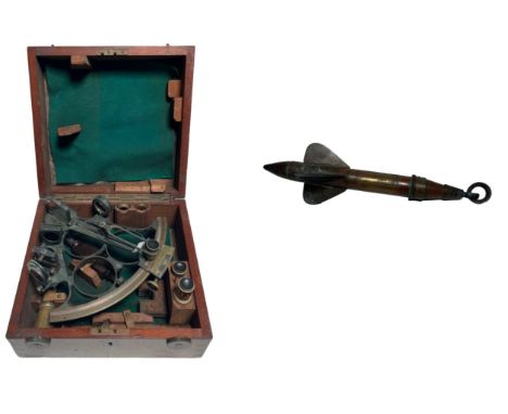
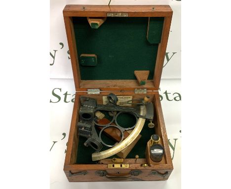
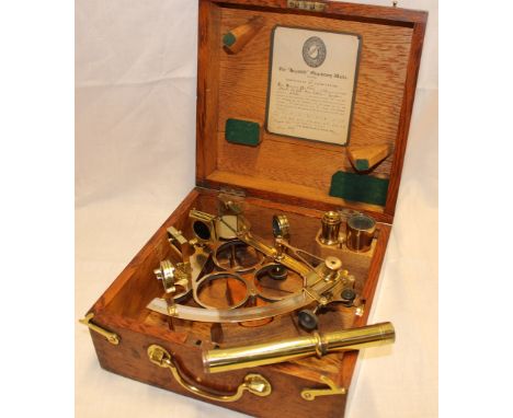
Lot 188
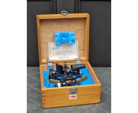
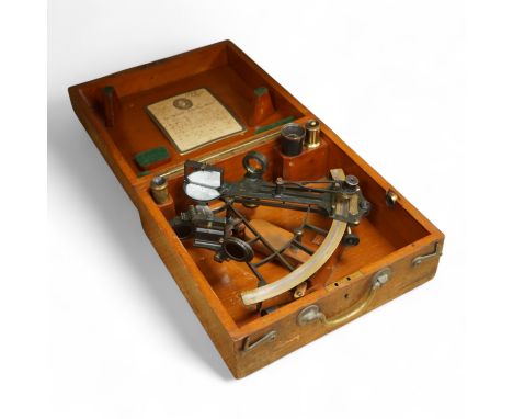
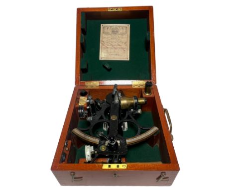
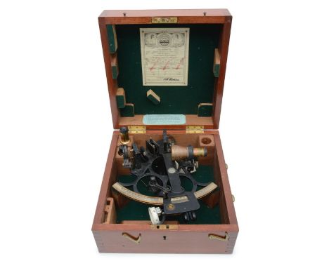
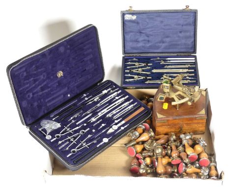
An early 20th century 8 inch radius vernier double frame sextant, maker Thomas Jones London, serial no. D125 with silvered arc calibrated to 140°, radius arm with fine adjust and a magnifier fitted mirrors and shades together with sighting tubes and accessories in a mahogany keystone case 11.5cm x 35cm x 29cm
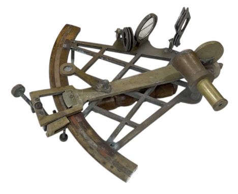
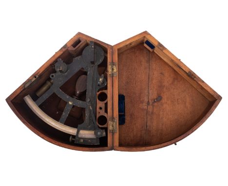
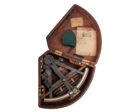
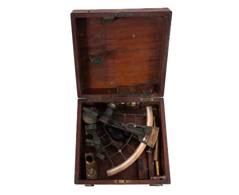
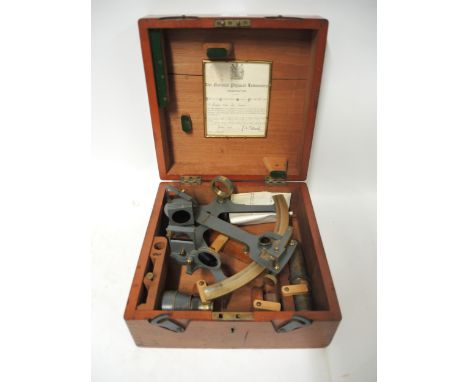
Lot 177
A late 19th/early 20th century 8 inch radius vernier sextant, maker probably J Cary , London, the silvered arc calibrated to 150°, fitted magnifier, mirrors and shades on a lacquered frame, together with sighting tubes and accessories in a mahogany keystone case, retailer's label for 'J Bruce & Son , London' the case 12x26x32cm (one section of base to case missing)
Lot 411
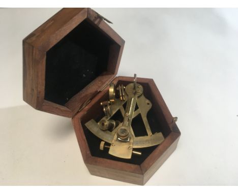
Antique brass sextant, ca. 1900, sold by James Murray, Calcutta, with protractor and original lenses, in accompanying wooden storage box. Colonial navigation instrument with typical British-Indian character0Antieke messing sextant, ca. 1900, verkocht door James Murray, Calcutta, met gradenboog en originele lenzen, in bijhorende houten opbergkist. Koloniaal navigatie-instrument met typisch Brits-Indisch karakterH 25 cm
Lot 417
Sewill Liverpool naval sextant and wooden sextant case plus hardcover 'A history of the navigator's sextants', Charlesh Cotter, first edition 1983Sewill Liverpool marine sextant en houten sextantkist plus hardcover ‘A history of the navigator's sextants’, Charlesh Cotter, eerste druk 1983.H 24 cm
Lot 30
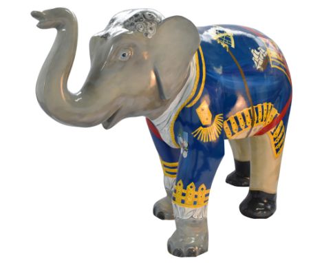
Lord Admiral TrunkstonExploring a nautical theme, this sculpture design is inspired by the naval history of our island nation. This maritime Elephant is all dressed up ready for another great seaborne adventure with his wig, wool coat, breeches, frilled shirt and medals. His map, sextant and binoculars at the ready and he’s even got a model sailing boat.by Ali Elly DesignsAli is an environmental artist, her work is continually inspired by the organic, chaotic patterns of the underwater world. With a strong emphasis on illustration her work explores the aesthetics of many marine species. Ali has her illustrations in all sorts of books and publications. Her main passion for conservation makes her work begin many interesting conversations.Trail Location West Bay: Esplanade.
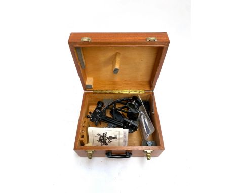
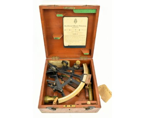
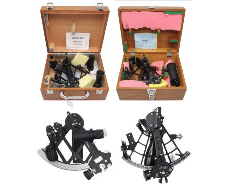
Lot 19
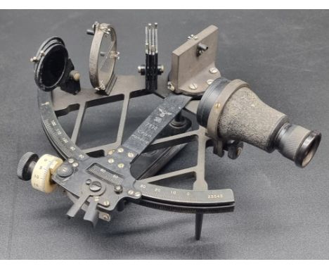
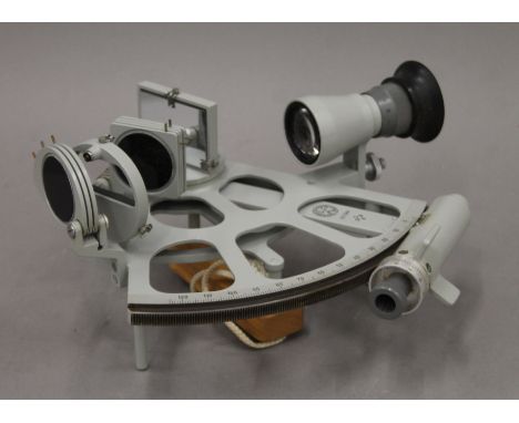
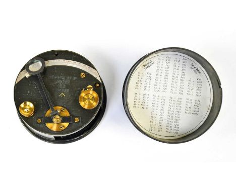
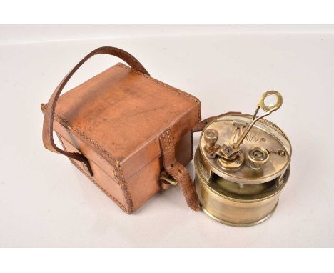
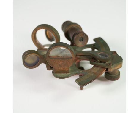
A 6IN. RADIUS MICROMETER SEXTANT BY HENRY HUGHES & SON LTD, LONDON, CIRCA 1943with three-circle crackle-finish brass frame, the polished-brass arc signed as per title and numbered 36236, with scale divided to 130°, index arm with micrometer, quick-release clamp and hinged lamp, Bakelite handle containing battery compartment and switches, contained within original fitted wooden case with accessories and test certificate for 1943 -- approx. 11in. (28cm.) square Arthur Smith, who served on minesweepers in 1943, and thence by descent.
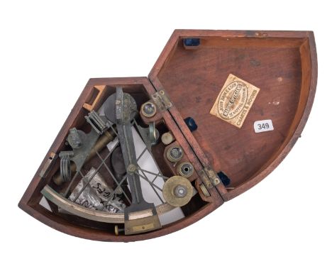
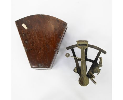
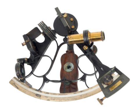
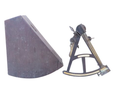
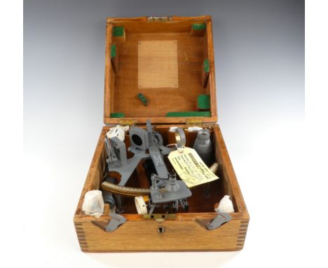
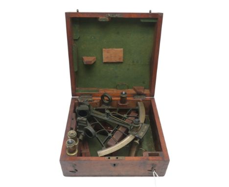
Lot 71
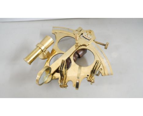
AN UNSIGNED 6¾IN. RADIUS VERNIER SEXTANT, EARLY 20TH CENTURY with oxidised brass three-circle frame, inset silvered scale divided to 140 degrees, reflector and swivel magnifier, seven shades, two mirrors, wooden handle and pin feet, contained within fitted wooden box of issue with accessories -- 5 x 10¼ x 9½in. (12.5 x 26 x 24cm.); together with a patent yacht log by Edward Massey (2)
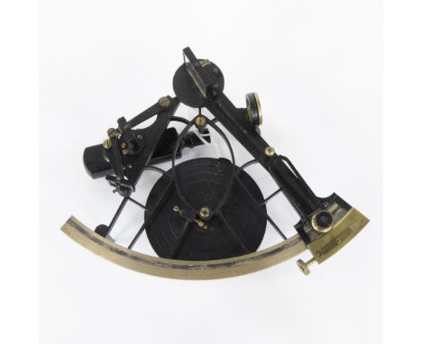
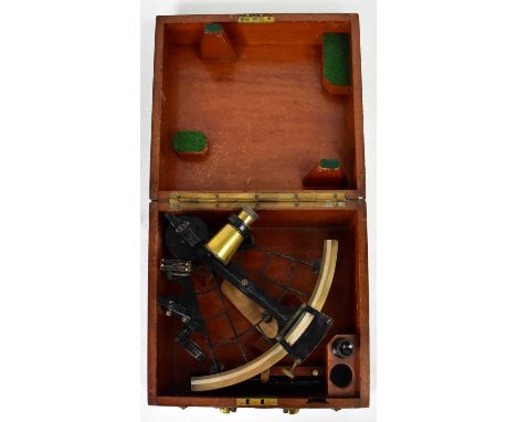
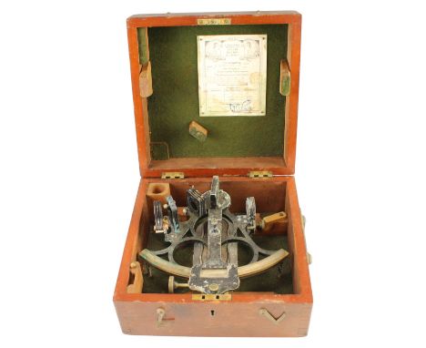
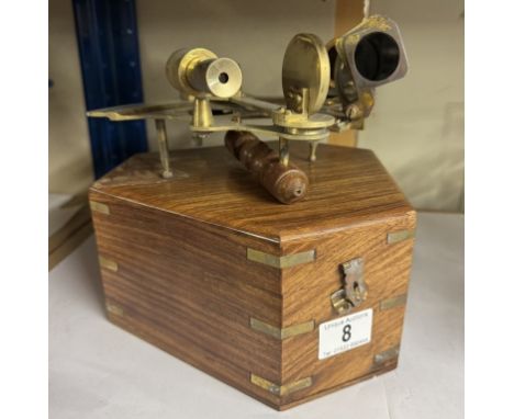
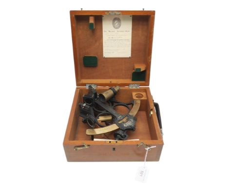
Lot 13
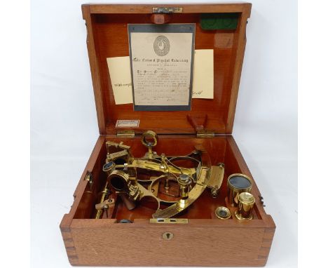
A 7IN. RADIUS BELL-FRAME VERNIER SEXTANT BY HEATH & CO., CIRCA 1914 the oxidised frame later ebonised with polished arc signed as per title and numbered L998, owner's name for A.A.D. La Touche R.N., 7 shades and 2 mirrors, vernier with clamp, wooden handle with ivorine plate, contained within original fitted wooden case with error certificate for 1914 -- 11in. (28cm.) wide
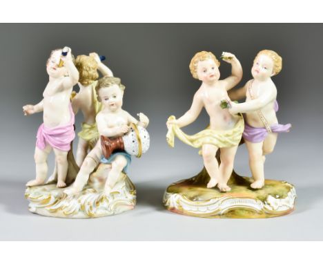
Lot 410
Two Meissen Allegorical Figures of Putti, Late 19th Century, both designed by Joann Joachim Kaendler (1706-1775), one model No. 2996 of two dancing putti on a Rococo base enamelled in colours and gilt, 4.25ins high overall, the other, model No. A12 depicting Astronomy with three putti, one holding a globe, one with a telescope, the other holding a sextant on Rococo base, enamelled in colours and gilt, 5ins high overall, both with incised and impressed numbers and blue crossed sword mark Model No. 2996 - floral wreath broken off and missing and flowers in putti's raised hand broken off and missingModel No. A12 - putti with globe- globe loose/broken at thumb joining globe to putti but present, natural left hand chipped/object missing, both feet badly chipped and natural right leg broken off and badly re-stuckputti with telescope - end of telescope broken off and missing, natural right arm broken at elbow and badly re-stuck, fingers on same hand also broken off (missing)putti with sextant - hand holding sextant has finger tips broken off (& missing) and sextant may have been restored, object in natural left hand broken offOtherwise these figures appear to be in good condition with no other obvious damage/loss/restoration
Lot 300
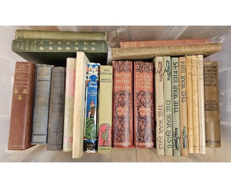
Assorted volumes to include Heinlein, Robert A "The Menace from the Earth" 1966, d-w, Harrison, Harry "War with the Robots", the Science Fiction Book Club 1968, Aliens Omnibus, the Boy's Friend magazine, assorted, "The Ninth Sextant Blake Omnibus" and assorted early 20th century volumes to include Fairless, Michael "The Road Mender", 2 vols, Laycock, Samuel "Warblins Fro' an Owd Songster", Galsworthy, John "Awakening", illustrated by R Sauter, Fairless, Michael "The Gathering of Brother Hilarious", Duckworth & Co, illustrations, Lang, John "Outposts of Empire" and "The Land of the Golden Trade", "Tales from Hoffman", Friedlander, V H "Mirrors and Angles", illustrated by Margaret Dobson, Country Life, Coote, Colin R "In and About Rome", Methuen, d-w, the Country Diary of an Edwardian Lady, Hanham, Alberta "Spin a Silver Dollar", illustrated by Beatien Yazz, d-w, MacKenzie, D A "Indian Myth and Legend", Gresham and many other assorted volumes (3 boxes)
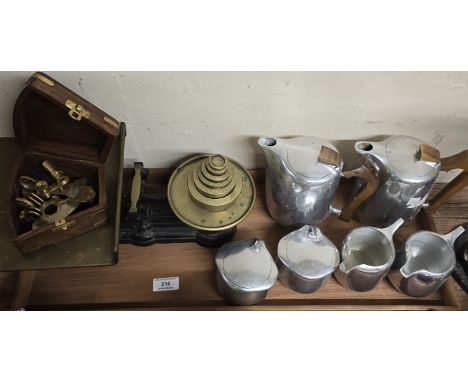
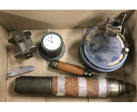
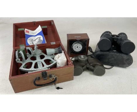
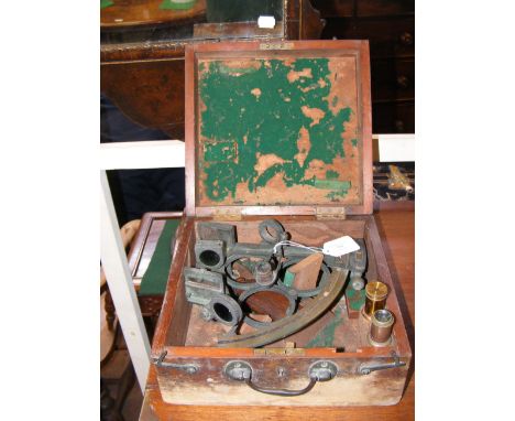
Lot 200
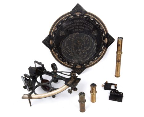
A box containing a leather and brass mounted three draw telescope, an oak and brass mounted three draw telescope of small proportions, a Junghans brass mounted car clock, the white enamel dial set with Arabic numerals, an unnamed brass cased sextant inscribed "Type 03AFT" numbered 471D and a brass possibly navigation tool inscribed with Arabic numerals and "Afternoon" and "Morning" to the sides and "Sun's declination" and "S.D" to the outside edges and a pocket knife (6)
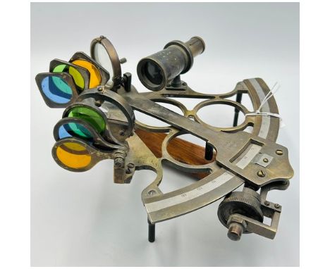
Lot 95
An early 20th-century vintage brass sextant, a precision navigational instrument used for celestial navigation at sea. Constructed from solid brass with aged patina, this sextant includes a fixed telescope, index arm, vernier scale, and multiple filters and mirrors. The instrument’s arc is finely engraved, and the build quality suggests it was crafted for maritime use or as a high-quality replica for educational or decorative purposes. With its mechanical elegance and historical appeal, it serves as a distinctive collector’s piece or nautical decor.Dimensions: 3.75"HIssued: c. 1950Condition: Age related wear.
-
4840 item(s)/page