No Image Lot 896 SOMERSET C.C.C. Over 110 home and away scorecards, 82 from the 1950's including v Australia 1953 and 896SOMERSET C.C.C. Over 110 home and away scorecards, 82 from the 1950's including v Australia 1953 and Sportingold Limited SOMERSET C.C.C. Over 110 home and away scorecards, 82 from the 1950's including v Australia 1953 and 1956, Pakistan 1954, India 1959, West I... Live
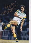
No Image Lot 1266 FRANK WORTHINGTON Autographed 12 x 8 col photo of Worthington in full length action for the Tampa 1266FRANK WORTHINGTON Autographed 12 x 8 col photo of Worthington in full length action for the Tampa Sportingold Limited FRANK WORTHINGTON Autographed 12 x 8 col photo of Worthington in full length action for the Tampa Bay Rowdies, c1981, signed All The Best in ... Live
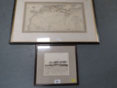
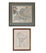
No Image Lot 5 A framed and glazed vintage map of Africa together with a smaller framed print (2) 5A framed and glazed vintage map of Africa together with a smaller framed print (2) Cuttlestones Auctioneers A framed and glazed vintage map of Africa together with a smaller framed print (2) Add to watchlist Live
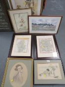
No Image Lot 46 A selection of pictures and maps to include a vintage print of two children fishing on the beach 46A selection of pictures and maps to include a vintage print of two children fishing on the beach Cuttlestones Auctioneers A selection of pictures and maps to include a vintage print of two children fishing on the beach etc. Add to watchlist Live
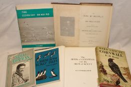
No Image Lot 98 Penhallurick (RD) The Birds of Cornwall and the Isles of Scilly 1978; 98Penhallurick (RD) The Birds of Cornwall and the Isles of Scilly 1978; Truro Auction Centre Penhallurick (RD) The Birds of Cornwall and the Isles of Scilly 1978; Rodd (EH) The Birds of Cornwall and the Scilly Islands 1880; Ryves (BH) Bird... Add to watchlist Live
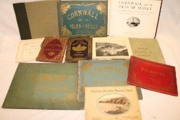
No Image Lot 149 Various albums of Cornish views including Best and Company Falmouth, 149Various albums of Cornish views including Best and Company Falmouth, Truro Auction Centre Various albums of Cornish views including Best and Company Falmouth, Lakes Cornwall and The Isles of Scilly, Hartnoll Brothers Views of Newquay an... Add to watchlist Live
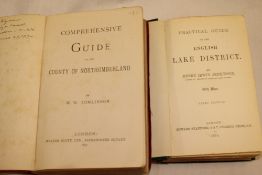
No Image Lot 158 A Jenkinson (H.W. 158A Jenkinson (H.W. Truro Auction Centre A Jenkinson (H.W.) Practical Guide to the English Lakes, 3rd edition with maps 1874; and Tomlinson (W.W.) Comprehensive Guide to the County of Nor... Add to watchlist Live
No Image Lot 169 Whittaker's School Atlas of Modern Geography, 1 vol London 1831, 169Whittaker's School Atlas of Modern Geography, 1 vol London 1831, Truro Auction Centre Whittaker's School Atlas of Modern Geography, 1 vol London 1831, containing 30 hand-coloured maps Add to watchlist Live
No Image Lot 189 DuFour (G. H. 189DuFour (G. H. Truro Auction Centre DuFour (G. H.) Three slip cases containing engraved maps of Switzerland 1865 published by Smith and Son, London Add to watchlist Live
No Image Lot 208 A large selection of various Ordnance Survey maps, 208A large selection of various Ordnance Survey maps, Truro Auction Centre A large selection of various Ordnance Survey maps, mainly mid to West Cornwall Add to watchlist Live
No Image Lot 250 2 x 17th century maps of Essex and Suffolk, framed (2) 2502 x 17th century maps of Essex and Suffolk, framed (2) Burstow & Hewett 2 x 17th century maps of Essex and Suffolk, framed (2) Add to watchlist Live
No Image Lot 252 17th century map of Huntingdon, hand coloured engraving, 39cm x 51cm, framed 25217th century map of Huntingdon, hand coloured engraving, 39cm x 51cm, framed Burstow & Hewett 17th century map of Huntingdon, hand coloured engraving, 39cm x 51cm, framed Add to watchlist Live
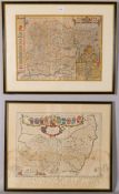
No Image Lot 253 Robert Morden, 2 maps of Norfolk and The North Riding Of Yorkshire, hand coloured engravings, framed 253Robert Morden, 2 maps of Norfolk and The North Riding Of Yorkshire, hand coloured engravings, framed Burstow & Hewett Robert Morden, 2 maps of Norfolk and The North Riding Of Yorkshire, hand coloured engravings, framed (2) Add to watchlist Live
No Image Lot 254 Robert Morden, 2 maps of Oxfordshire and Northamptonshire, hand coloured engravings, framed (2) 254Robert Morden, 2 maps of Oxfordshire and Northamptonshire, hand coloured engravings, framed (2) Burstow & Hewett Robert Morden, 2 maps of Oxfordshire and Northamptonshire, hand coloured engravings, framed (2) Add to watchlist Live
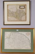
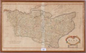
No Image Lot 255 Robert Morden, map of Kent, hand coloured engraving, framed 255Robert Morden, map of Kent, hand coloured engraving, framed Burstow & Hewett Robert Morden, map of Kent, hand coloured engraving, framed Add to watchlist Live
No Image Lot 256 2 x 17th century maps of Denbigh and Flintshire and Lincolnshire, framed (2) 2562 x 17th century maps of Denbigh and Flintshire and Lincolnshire, framed (2) Burstow & Hewett 2 x 17th century maps of Denbigh and Flintshire and Lincolnshire, framed (2) Add to watchlist Live
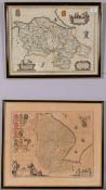
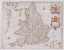
No Image Lot 257 William Blaeu, map of Anglia Regnum, 17th century hand coloured engraving, 39cm x 49cm, mounted 257William Blaeu, map of Anglia Regnum, 17th century hand coloured engraving, 39cm x 49cm, mounted Burstow & Hewett William Blaeu, map of Anglia Regnum, 17th century hand coloured engraving, 39cm x 49cm, mounted Add to watchlist Live
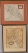
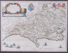
No Image Lot 258 Johannes Blaeu, map of Dorsetshire, 17th century hand coloured engraving, 38cm x 50cm, mounted 258Johannes Blaeu, map of Dorsetshire, 17th century hand coloured engraving, 38cm x 50cm, mounted Burstow & Hewett Johannes Blaeu, map of Dorsetshire, 17th century hand coloured engraving, 38cm x 50cm, mounted Add to watchlist Live
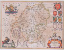
No Image Lot 259 Joan Blaeu, map of West Morland, 17th century hand coloured engraving, 38cm x 49cm, mounted 259Joan Blaeu, map of West Morland, 17th century hand coloured engraving, 38cm x 49cm, mounted Burstow & Hewett Joan Blaeu, map of West Morland, 17th century hand coloured engraving, 38cm x 49cm, mounted Add to watchlist Live
No Image Lot 260 John Ogilby, road map from London to Bristol, and another from London to Arundel, 17th century 260John Ogilby, road map from London to Bristol, and another from London to Arundel, 17th century Burstow & Hewett John Ogilby, road map from London to Bristol, and another from London to Arundel, 17th century hand coloured engravings, framed (2) Add to watchlist Live
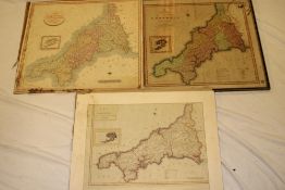
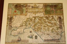
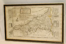
No Image Lot 264 An 18th century hand coloured map of Cornwall 1790, 264An 18th century hand coloured map of Cornwall 1790, Truro Auction Centre An 18th century hand coloured map of Cornwall 1790, New Map of the County of Cornwall printed for C Smith 1801 and a map of Cornwall divided into ... Add to watchlist Live
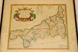
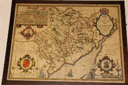
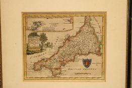
No Image Lot 265 An 18th Century hand coloured map of Cornwall by Robert Morden, 265An 18th Century hand coloured map of Cornwall by Robert Morden, Truro Auction Centre An 18th Century hand coloured map of Cornwall by Robert Morden, framed and glazed Add to watchlist Live
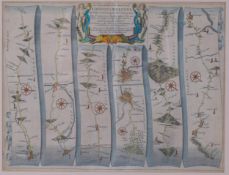
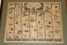
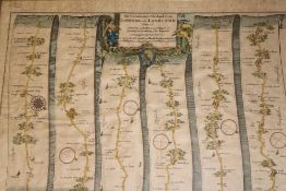
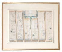
No Image Lot 266 An 18th Century hand coloured strip map of the road from Exeter to Truro by John Ogilby, 14" x 18", 266An 18th Century hand coloured strip map of the road from Exeter to Truro by John Ogilby, 14" x 18", Truro Auction Centre An 18th Century hand coloured strip map of the road from Exeter to Truro by John Ogilby, 14" x 18", framed and glazed Add to watchlist Live
No Image Lot 267 Three 18th century hand coloured strip maps "The Continuation of the Road from London to the Lands 267Three 18th century hand coloured strip maps "The Continuation of the Road from London to the Lands Truro Auction Centre Three 18th century hand coloured strip maps "The Continuation of the Road from London to the Lands End" including plate 2 "Andover to Crookhorn"; ... Add to watchlist Live
No Image Lot 268 An early 17th century hand coloured map of the County of Monmouth by John Speede, 1610, 268An early 17th century hand coloured map of the County of Monmouth by John Speede, 1610, Truro Auction Centre An early 17th century hand coloured map of the County of Monmouth by John Speede, 1610, 15½" x 20½" Add to watchlist Live
No Image Lot 269 An early 17th century hand coloured map of Glamorganshire "Glamorgan Shire - With the Situations of 269An early 17th century hand coloured map of Glamorganshire "Glamorgan Shire - With the Situations of Truro Auction Centre An early 17th century hand coloured map of Glamorganshire "Glamorgan Shire - With the Situations of the Chief Town Cardiff and Ancient Landscape D... Add to watchlist Live
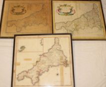
No Image Lot 270 Two 18th century hand coloured maps of Cornwall by Robert Morden and one other 19th century hand 270Two 18th century hand coloured maps of Cornwall by Robert Morden and one other 19th century hand Truro Auction Centre Two 18th century hand coloured maps of Cornwall by Robert Morden and one other 19th century hand coloured map of Cornwall by Cadell and Davies 181... Add to watchlist Live
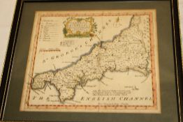
No Image Lot 270A An early 19th Century hand coloured map of Cornwall "Divided into it's Hundreds" by E. 270AAn early 19th Century hand coloured map of Cornwall "Divided into it's Hundreds" by E. Truro Auction Centre An early 19th Century hand coloured map of Cornwall "Divided into it's Hundreds" by E. Bowen, framed and glazed Add to watchlist Live
No Image Lot 271 An 18th Century hand coloured map "A Modern Map of Cornwall" by Walpole, 271An 18th Century hand coloured map "A Modern Map of Cornwall" by Walpole, Truro Auction Centre An 18th Century hand coloured map "A Modern Map of Cornwall" by Walpole, framed Add to watchlist Live
No Image Lot 272 An 18th Century map of Cornwall by H. 272An 18th Century map of Cornwall by H. Truro Auction Centre An 18th Century map of Cornwall by H. Moll, framed and glazed Add to watchlist Live
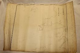
No Image Lot 273 A late 18th - early 19th Century hand drawn map of the Roads of Revel by T. 273A late 18th - early 19th Century hand drawn map of the Roads of Revel by T. Truro Auction Centre A late 18th - early 19th Century hand drawn map of the Roads of Revel by T. Durant with manuscript text, 21½" x 16" Add to watchlist Live
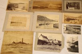
No Image Lot 334 A selection of early photographs of Cornwall including the wreck of the SS Bluejacket by Gibson of 334A selection of early photographs of Cornwall including the wreck of the SS Bluejacket by Gibson of Truro Auction Centre A selection of early photographs of Cornwall including the wreck of the SS Bluejacket by Gibson of Penzance, two photographs of the SS "Lady of th... Add to watchlist Live
No Image Lot 336 A selection of Cornish paperwork and memorabilia including North Cornwall Mission St. 336A selection of Cornish paperwork and memorabilia including North Cornwall Mission St. Truro Auction Centre A selection of Cornish paperwork and memorabilia including North Cornwall Mission St. Columb, Bazaar Souvenir Cookery Recipes, Old Cornwall in Cam... Add to watchlist Live
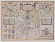
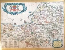
No Image Lot 350 Richard Blome (1635–1705) antique map of Somerset - frame 29.5cm x 37.5cm ~ the map has been 350Richard Blome (1635–1705) antique map of Somerset - frame 29.5cm x 37.5cm ~ the map has been Acreman St. Antiques Auction Richard Blome (1635–1705) antique map of Somerset - frame 29.5cm x 37.5cm ~ the map has been trimmed Add to watchlist Live
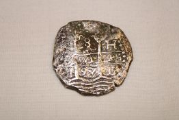
No Image Lot 684 A 17th Century silver hammered piece of eight coin 1697, 684A 17th Century silver hammered piece of eight coin 1697, Truro Auction Centre A 17th Century silver hammered piece of eight coin 1697, originally recovered from the wreck of HMS Association, wrecked off the Isles of Scilly i... Add to watchlist Live
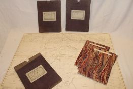
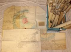
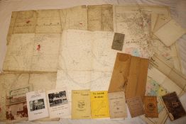
No Image Lot 1130 Crate containing a large quantity of maps 1130Crate containing a large quantity of maps W&H Peacock Auctioneers & Valuers Crate containing a large quantity of maps Add to watchlist Live
No Image Lot 1739 +VAT Welhome 4 piece 500 thread count, hygrocotton lyocell duvet set - king size 1739+VAT Welhome 4 piece 500 thread count, hygrocotton lyocell duvet set - king size W&H Peacock Auctioneers & Valuers +VAT Welhome 4 piece 500 thread count, hygrocotton lyocell duvet set - king size Add to watchlist Live
No Image Lot 233 A vintage Dartmoor Ordnance Survey map, a 1939 Flying magazine, a Cornish 19thC. family bible relati 233A vintage Dartmoor Ordnance Survey map, a 1939 Flying magazine, a Cornish 19thC. family bible relati Clarks Auction Rooms A vintage Dartmoor Ordnance Survey map, a 1939 Flying magazine, a Cornish 19thC. family bible relating to the Boney family of Davidstow, Altarnun,... Add to watchlist Live
No Image Lot 271 JOHN OGILBY (1600-1676) Three strip road maps 271JOHN OGILBY (1600-1676) Three strip road maps Duke's JOHN OGILBY (1600-1676) Three strip road maps comprising 'London to Flamborough', 'London to Barwick' and 'London to Flamborough Head', engraved m... Add to watchlist Live
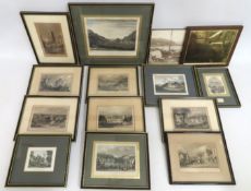
No Image Lot 299 A quantity of framed antique engravings including 299A quantity of framed antique engravings including Clarks Auction Rooms A quantity of framed antique engravings including Fowey, Polperro, Truro, Bodmin, Lanhydroc, Morvall, Looe & a brass map after John Speed Add to watchlist Live
No Image Lot 319 Maps Travel and Tourism Books Paper Items Collectables Vintage 577697 319Maps Travel and Tourism Books Paper Items Collectables Vintage 577697 Potters Auction Saleroom Maps Travel and Tourism Books Paper Items Collectables Vintage 577697 Add to watchlist Live
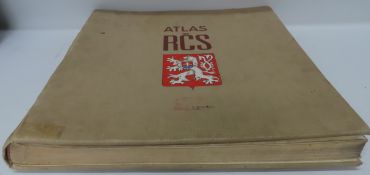
No Image Lot 1278 Large vintage Czech republic Atlas. 1278Large vintage Czech republic Atlas. Potters Auction Saleroom Large vintage Czech republic Atlas. Add to watchlist Live
Reserve not met No Image Lot 1031 A MAP OF EUROPE, AFTER HOMANN HEIRS, 'HAAS MAP OF EUROPE', TOGETHER WITH ANOTHER MAP 1031A MAP OF EUROPE, AFTER HOMANN HEIRS, 'HAAS MAP OF EUROPE', TOGETHER WITH ANOTHER MAP Dreweatts 1759 A MAP OF EUROPE, AFTER HOMANN HEIRS, 'HAAS MAP OF EUROPE' Hand coloured engraving, decorative cartouche upper left and a mile scale low... Add to watchlist Timed
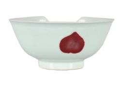
Reserve not met No Image Lot 1085 A CHINESE UNDERGLAZED RED 'PROSPERITIY' BOWL 1085A CHINESE UNDERGLAZED RED 'PROSPERITIY' BOWL Dreweatts 1759 A CHINESE UNDERGLAZED RED 'PROSPERITIY' BOWL 13.3cm diameter This item is offered at no reserve Condition Report: PLEASE N... Add to watchlist Timed
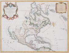
No Image Lot 37 America.- Jaillot (Alexis-Hubert) and Nicolas Sanson. Amerique Septentrionale Divisee en ses Prin... 37America.- Jaillot (Alexis-Hubert) and Nicolas Sanson. Amerique Septentrionale Divisee en ses Prin... Forum Auctions America.- Jaillot (Alexis-Hubert) and Nicolas Sanson. Amerique Septentrionale Divisee en ses Principales Parties, ou sont Distingues les uns des A... Add to watchlist Live
No Image Lot 38 America.- Jefferys (Thomas) The American Atlas 1776, out-of-series copy from an edition of 200, 1... 38America.- Jefferys (Thomas) The American Atlas 1776, out-of-series copy from an edition of 200, 1... Forum Auctions America.- Jefferys (Thomas) The American Atlas 1776, out-of-series copy from an edition of 200, 30 maps, most double-page or folding, original ha... Add to watchlist Live
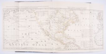
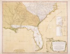
No Image Lot 39 America.- Laurie & Whittle (publishers) A New and General Map of the Southern Dominions Belonging... 39America.- Laurie & Whittle (publishers) A New and General Map of the Southern Dominions Belonging... Forum Auctions America.- Laurie & Whittle (publishers) A New and General Map of the Southern Dominions Belonging to The United States of America, engraved map wi... Add to watchlist Live
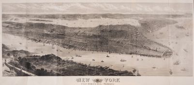
No Image Lot 42 America.- New York.- Illustrated London News (The) New York from Bergen Hill: Hoboken, wood-engra... 42America.- New York.- Illustrated London News (The) New York from Bergen Hill: Hoboken, wood-engra... Forum Auctions America.- New York.- Illustrated London News (The) New York from Bergen Hill: Hoboken, wood-engraved panorama after T. Sulman, on thin wove paper,... Add to watchlist Live
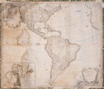
No Image Lot 46 America.- Robert de Vaugondy (Gilles) L'Amérique septentrionale et méridionale divisée suivant se... 46America.- Robert de Vaugondy (Gilles) L'Amérique septentrionale et méridionale divisée suivant se... Forum Auctions America.- Robert de Vaugondy (Gilles) L'Amérique septentrionale et méridionale divisée suivant ses différens pays, wall map of the Americas, engra... Add to watchlist Live
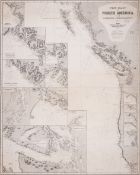
No Image Lot 48 America.- San Francisco.- Imray & Son (James) West Coast of North America from San Francisco to Q... 48America.- San Francisco.- Imray & Son (James) West Coast of North America from San Francisco to Q... Forum Auctions America.- San Francisco.- Imray & Son (James) West Coast of North America from San Francisco to Queen Charlotte Ids., blue-back chart, engraving, ... Add to watchlist Live
No Image Lot 65 Asia.- Heine (Wilhelm) Die Expedition in die Seen von China, Japan und Ochotsk, 3 vol., first edi... 65Asia.- Heine (Wilhelm) Die Expedition in die Seen von China, Japan und Ochotsk, 3 vol., first edi... Forum Auctions Asia.- Heine (Wilhelm) Die Expedition in die Seen von China, Japan und Ochotsk, 3 vol., first edition, frontispieces, 21 plates, illustrations, 7 ... Add to watchlist Live
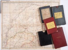
No Image Lot 72 Asia.- Various cartographers (19th century) Collection of 7 folding maps, and a boxed quantity of... 72Asia.- Various cartographers (19th century) Collection of 7 folding maps, and a boxed quantity of... Forum Auctions Asia.- Various cartographers (19th century) Collection of 7 folding maps, and a boxed quantity of miscellaneous prints, many with Indian Subcontin... Add to watchlist Live
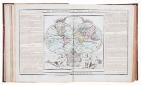
No Image Lot 73 Atlases.- Desnos (Louis-Charles) Atlas general et elementaire pour l'etude de la geographie et de... 73Atlases.- Desnos (Louis-Charles) Atlas general et elementaire pour l'etude de la geographie et de... Forum Auctions Atlases.- Desnos (Louis-Charles) Atlas general et elementaire pour l'etude de la geographie et de l'histoire moderne, engraved title, 67 double-pa... Add to watchlist Live
No Image Lot 80 Australia.- Sturt (Captain Charles) Two Expeditions into the Interior of Southern Australia, 2 vo... 80Australia.- Sturt (Captain Charles) Two Expeditions into the Interior of Southern Australia, 2 vo... Forum Auctions Australia.- Sturt (Captain Charles) Two Expeditions into the Interior of Southern Australia, 2 vol., second edition, half-titles, frontispieces, 1... Add to watchlist Live
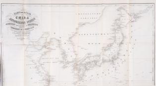
No Image Lot 90 China.- Coronelli (Vincenzo Maria) Iunan Queicheu e Quangs Provincie della China, engraved map, [... 90China.- Coronelli (Vincenzo Maria) Iunan Queicheu e Quangs Provincie della China, engraved map, [... Forum Auctions China.- Coronelli (Vincenzo Maria) Iunan Queicheu e Quangs Provincie della China, engraved map with original hand-colouring, platemark 460 x 610 m... Add to watchlist Live
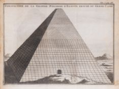
No Image Lot 115 Egypt.- Lucas (Paul) Voyage...dans la Turquie, l'Asie, Sourie, Palestine, Haute & Basse Egypte, 2... 115Egypt.- Lucas (Paul) Voyage...dans la Turquie, l'Asie, Sourie, Palestine, Haute & Basse Egypte, 2... Forum Auctions Egypt.- Lucas (Paul) Voyage...dans la Turquie, l'Asie, Sourie, Palestine, Haute & Basse Egypte, 2 vol., third edition, titles in red and black, 2 ... Add to watchlist Live
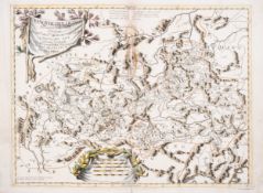
No Image Lot 120 Europe.- Austro-Hungarian Empire.- Topographisches Bureau des K.K. Generalq (Publisher) Das Oeste... 120Europe.- Austro-Hungarian Empire.- Topographisches Bureau des K.K. Generalq (Publisher) Das Oeste... Forum Auctions Europe.- Austro-Hungarian Empire.- Topographisches Bureau des K.K. Generalq (Publisher) Das Oesterreichische-Kaiserthum : mit beträchtlichen Theil... Add to watchlist Live
No Image Lot 121 Europe.- Chauchard (Captain Jean Baptiste Hippolyte) A General Map of the Empire of Germany, Holl... 121Europe.- Chauchard (Captain Jean Baptiste Hippolyte) A General Map of the Empire of Germany, Holl... Forum Auctions Europe.- Chauchard (Captain Jean Baptiste Hippolyte) A General Map of the Empire of Germany, Holland, The Netherlands, Switzerland..., title, dedi... Add to watchlist Live
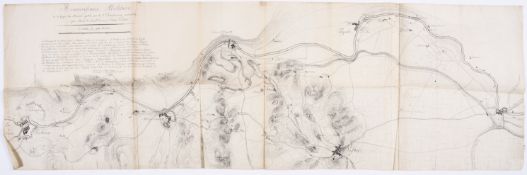
No Image Lot 132 Europe.- Napoleon.- The Battle of Borghetto, Italy.- Anonymous French Soldier (active 1790s) Réco... 132Europe.- Napoleon.- The Battle of Borghetto, Italy.- Anonymous French Soldier (active 1790s) Réco... Forum Auctions Europe.- Napoleon.- The Battle of Borghetto, Italy.- Anonymous French Soldier (active 1790s) Réconnaissance Militaire de la Ligne du Mincio gardée... Add to watchlist Live