No Image Lot 896 SOMERSET C.C.C. Over 110 home and away scorecards, 82 from the 1950's including v Australia 1953 and 896SOMERSET C.C.C. Over 110 home and away scorecards, 82 from the 1950's including v Australia 1953 and Sportingold Limited SOMERSET C.C.C. Over 110 home and away scorecards, 82 from the 1950's including v Australia 1953 and 1956, Pakistan 1954, India 1959, West I... Live
No Image Lot 1266 FRANK WORTHINGTON Autographed 12 x 8 col photo of Worthington in full length action for the Tampa 1266FRANK WORTHINGTON Autographed 12 x 8 col photo of Worthington in full length action for the Tampa Sportingold Limited FRANK WORTHINGTON Autographed 12 x 8 col photo of Worthington in full length action for the Tampa Bay Rowdies, c1981, signed All The Best in ... Live
No Image Lot 3500 END OF SALE, THANK YOU FOR YOUR BIDDING. OUR NEXT SALE IS ON THE WEDNESDAY 23RD AND THURSDAY 24TH 3500END OF SALE, THANK YOU FOR YOUR BIDDING. OUR NEXT SALE IS ON THE WEDNESDAY 23RD AND THURSDAY 24TH Ashley Waller Auctioneers END OF SALE, THANK YOU FOR YOUR BIDDING. OUR NEXT SALE IS ON THE WEDNESDAY 23RD AND THURSDAY 24TH JULY Add to watchlist Live
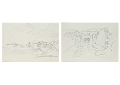
No Image Lot 375 Bryan INGHAM (1936-1997) Two works 375Bryan INGHAM (1936-1997) Two works Lay's Auctioneers Bryan INGHAM (1936-1997) Two works Off St Martin (Isles of Scilly), c1994, pen on paper, titled, 21 x 30cm, framed 31 x 40cm St Martin (Isles of... Add to watchlist Live
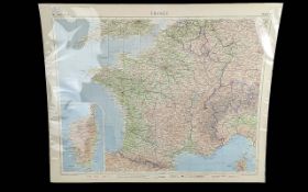
No Image Lot 980 Colour Map of France, plate 67,John Bartholomew and son,1955-59. 980Colour Map of France, plate 67,John Bartholomew and son,1955-59. Gerrards Auction Rooms Colour Map of France, plate 67,John Bartholomew and son,1955-59. "The Times Atlas" printed on upper left corner.x1 Add to watchlist Live
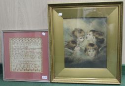
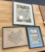
No Image Lot 117 A selection of original needlework's & maps, various, 117A selection of original needlework's & maps, various, Bigwood Fine Art Auctioneers A selection of original needlework's & maps, various, together with a map of Blockley & other pictures Add to watchlist Live
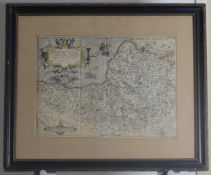
No Image Lot 183 Two maps one of Herefordshire, the other Warwickshire, framed & glazed 183Two maps one of Herefordshire, the other Warwickshire, framed & glazed Bigwood Fine Art Auctioneers Two maps one of Herefordshire, the other Warwickshire, framed & glazed Additional Info: Herefordshire - 38cm x 51cm, double glazed, revealing text... Add to watchlist Live
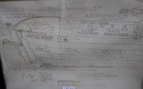
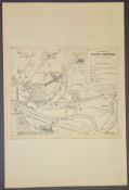
No Image Lot 212 A framed Narrow Boat blueprint 212A framed Narrow Boat blueprint Bigwood Fine Art Auctioneers A framed Narrow Boat blueprint Add to watchlist Live
No Image Lot 216 A framed and glazed map of Scilly Isles, together with another framed print 216A framed and glazed map of Scilly Isles, together with another framed print Bigwood Fine Art Auctioneers A framed and glazed map of Scilly Isles, together with another framed print Add to watchlist Live
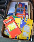
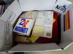
No Image Lot 297 A box containing a selection of road maps, various cities & countries 297A box containing a selection of road maps, various cities & countries Bigwood Fine Art Auctioneers A box containing a selection of road maps, various cities & countries Add to watchlist Live
No Image Lot 411 A 19th century French needlework sampler, by Marie Jerrold, aged 10, from Boulogne Sur Mer, 25cm squ 411A 19th century French needlework sampler, by Marie Jerrold, aged 10, from Boulogne Sur Mer, 25cm squ Bigwood Fine Art Auctioneers A 19th century French needlework sampler, by Marie Jerrold, aged 10, from Boulogne Sur Mer, 25cm square, framed and glazed, together with a gilt f... Add to watchlist Live
Reserve not met No Image Lot 13 EARLY PRINT OF JOHANN DANIEL FLEISCHBEIN VON KLEEBERG 13EARLY PRINT OF JOHANN DANIEL FLEISCHBEIN VON KLEEBERG Southgate Auction Rooms EARLY PRINT OF JOHANN DANIEL FLEISCHBEIN VON KLEEBERG Add to watchlist Timed
Reserve not met No Image Lot 15 EARLY PRINT OF PORTRAIT OF JOHANNES DANIEL ARCULARIUS 15EARLY PRINT OF PORTRAIT OF JOHANNES DANIEL ARCULARIUS Southgate Auction Rooms EARLY PRINT OF PORTRAIT OF JOHANNES DANIEL ARCULARIUS Add to watchlist Timed
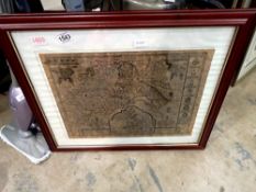
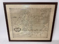
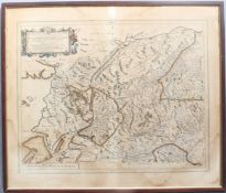
Reserve not met No Image Lot 43 EARLY MAP 43EARLY MAP Southgate Auction Rooms EARLY MAP Add to watchlist Timed
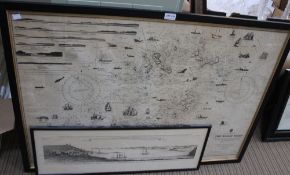
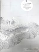
Reserve not met No Image Lot 55 A large quantity of maritime charts, approximately 100 including Scotland, Ireland, Isle of Mann and 55A large quantity of maritime charts, approximately 100 including Scotland, Ireland, Isle of Mann and Browns A large quantity of maritime charts, approximately 100 including Scotland, Ireland, Isle of Mann and England, . Add to watchlist Timed
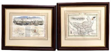
Reserve not met No Image Lot 261 A late 19th c. map by J Rapkin, "Turkey in Europe", published J & F Tallis, 28 x 35 cm, and a 1850 261A late 19th c. map by J Rapkin, "Turkey in Europe", published J & F Tallis, 28 x 35 cm, and a 1850 Browns A late 19th c. map by J Rapkin, "Turkey in Europe", published J & F Tallis, 28 x 35 cm, and a 1850 London Illustrated News page reporting the firs... Add to watchlist Timed
No Image Lot 367 Scotland: Blaeu (Johannes & Pont Timothy) - engraved map with outline hand colouring, 'Scotiae 367Scotland: Blaeu (Johannes & Pont Timothy) - engraved map with outline hand colouring, 'Scotiae Tayler & Fletcher Scotland: Blaeu (Johannes & Pont Timothy) - engraved map with outline hand colouring, 'Scotiae provinciae mediterraneae inter Taum flumen et Uarar... Add to watchlist Live
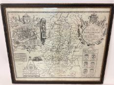
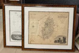
No Image Lot 389 A 19th Century map of the county of Nottinghamshire and a later map of Derbyshire, framed 389A 19th Century map of the county of Nottinghamshire and a later map of Derbyshire, framed Arthur Johnson & Sons Auctioneers A 19th Century map of the county of Nottinghamshire and a later map of Derbyshire, framed Add to watchlist Live
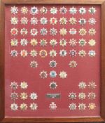
No Image Lot 729 A comprehensive framed and glazed display of British Fire Authority Cap Badges, c.1993 - including a 729A comprehensive framed and glazed display of British Fire Authority Cap Badges, c.1993 - including a Tayler & Fletcher A comprehensive framed and glazed display of British Fire Authority Cap Badges, c.1993 - including a complete set of 45 x English badges, 7 x Chan... Add to watchlist Live
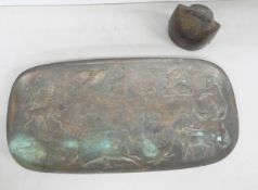
No Image Lot 2047 A Ceskoslovensko metal ashtray, embossed with wild animals and a map, 17.5cms w, together with a 2047A Ceskoslovensko metal ashtray, embossed with wild animals and a map, 17.5cms w, together with a Arthur Johnson & Sons Auctioneers A Ceskoslovensko metal ashtray, embossed with wild animals and a map, 17.5cms w, together with a metal cattle bell, Devouassoud Add to watchlist Live
No Image Lot 13 Three vintage framed maps largest measures approximately 15 inches by 12 inches 13Three vintage framed maps largest measures approximately 15 inches by 12 inches Sutton Hill Farm Country Auctions Three vintage framed maps largest measures approximately 15 inches by 12 inches Add to watchlist Live
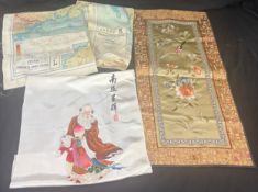
No Image Lot 45 Selection of vintage silk maps showing China, French Indo China, satin oriental pieces 45Selection of vintage silk maps showing China, French Indo China, satin oriental pieces Sutton Hill Farm Country Auctions Selection of vintage silk maps showing China, French Indo China, satin oriental pieces Add to watchlist Live
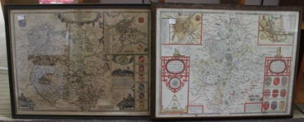
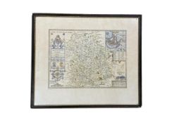
No Image Lot 158 SOMERSET: Christopher Saxton (c.1540-c.1610), & William Kip (fl. 1585-1618), 'Somersettensis 158SOMERSET: Christopher Saxton (c.1540-c.1610), & William Kip (fl. 1585-1618), 'Somersettensis Chilcotts SOMERSET: Christopher Saxton (c.1540-c.1610), & William Kip (fl. 1585-1618), 'Somersettensis Comitatus Vulgo Somersett Shyre qui olim pars fuit Be... Add to watchlist Live
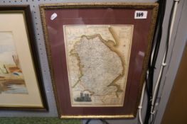
No Image Lot 169 Framed Coloured Map of Lincolnshire by Pigot & Co 169Framed Coloured Map of Lincolnshire by Pigot & Co Hyperion Auctions Framed Coloured Map of Lincolnshire by Pigot & Co Add to watchlist Live
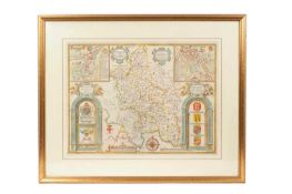
No Image Lot 732 John Speed (1552-1629) hand coloured map of Shropshire, published by Thomas Bassett and Richard 732John Speed (1552-1629) hand coloured map of Shropshire, published by Thomas Bassett and Richard John Rolfe Auctions John Speed (1552-1629) hand coloured map of Shropshire, published by Thomas Bassett and Richard Chiswell, containing the Royal arms, the arms of R... Add to watchlist Live
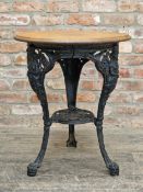
No Image Lot 1205 Victorian cast iron Britannia pub table with stripped top, H 70cm x W 60cm 1205Victorian cast iron Britannia pub table with stripped top, H 70cm x W 60cm John Rolfe Auctions Victorian cast iron Britannia pub table with stripped top, H 70cm x W 60cm Add to watchlist Live
No Image Lot 5147 Qty of ordinance survey maps 5147Qty of ordinance survey maps W&H Peacock Auctioneers & Valuers Qty of ordinance survey maps Add to watchlist Live
No Image Lot 5393 Map stand plus political map 5393Map stand plus political map W&H Peacock Auctioneers & Valuers Map stand plus political map Add to watchlist Live
No Image Lot 5486 Box containing OS and other maps 5486Box containing OS and other maps W&H Peacock Auctioneers & Valuers Box containing OS and other maps Add to watchlist Live
No Image Lot 5524 2 boxes containing ordinance survey maps 55242 boxes containing ordinance survey maps W&H Peacock Auctioneers & Valuers 2 boxes containing ordinance survey maps Add to watchlist Live
No Image Lot 690 A Set of Eleven Montagu's Road Maps of The British Isles, numbers 1-11, contained in a leather and 690A Set of Eleven Montagu's Road Maps of The British Isles, numbers 1-11, contained in a leather and Tennants Auctioneers A Set of Eleven Montagu's Road Maps of The British Isles, numbers 1-11, contained in a leather and pig skin case, the hinged lid labelled The Car ... Add to watchlist Live
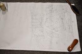
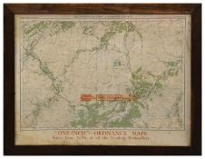
No Image Lot 790 L&NER Grantown-On-Spey Station Display Map 790L&NER Grantown-On-Spey Station Display Map Tennants Auctioneers L&NER Grantown-On-Spey Station Display Map section of One-Inch Ordnance Map 'Grantown-on-Spey & Strath Dearn' adverting the sale of OS Maps '..fro... Add to watchlist Live
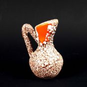
No Image Lot 182 PANASSIDI. Attributed to. JUG. 182PANASSIDI. Attributed to. JUG. Lots Road Auctions PANASSIDI. Attributed to. JUG. Ceramic," Ecume de Mer" glaze with Lava glazed "Tear drop", 14cms High, (Produced Vallauris c1965). Add to watchlist Live
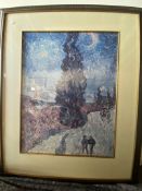
Reserve not met No Image Lot 560 Framed Van Gogh print of Road with Cypress and Star 560Framed Van Gogh print of Road with Cypress and Star Hudson's Home & Antiques Framed Van Gogh print of Road with Cypress and Star 100 x 80cm Add to watchlist Timed
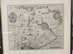
Reserve not met No Image Lot 596 Biblical map by Thomas Bowyer depicting Galilee 596Biblical map by Thomas Bowyer depicting Galilee Hudson's Home & Antiques Biblical map by Thomas Bowyer depicting Galilee Add to watchlist Timed
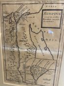
Reserve not met No Image Lot 600 Herman Moll 1726 map of Egypt 600Herman Moll 1726 map of Egypt Hudson's Home & Antiques Herman Moll 1726 map of Egypt, retailed by Sanders of Oxford Ltd - rare prints and maps 32 x 41 cm framed Add to watchlist Timed
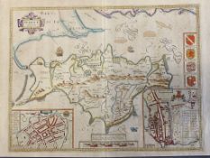
Reserve not met No Image Lot 608 John Speed - 'Wight Island': map of the Isle of Wight, engraving with hand colouring, 'Described by 608John Speed - 'Wight Island': map of the Isle of Wight, engraving with hand colouring, 'Described by Hudson's Home & Antiques John Speed - 'Wight Island': map of the Isle of Wight, engraving with hand colouring, 'Described by William White Gent. Augmented and published by... Add to watchlist Timed
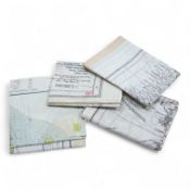
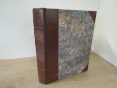
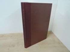
Reserve not met No Image Lot 550 Maps/Atlases. Two titles: Bartholomew, J. G. [ed.] - The Royal Atlas of England and Wales. London: 550Maps/Atlases. Two titles: Bartholomew, J. G. [ed.] - The Royal Atlas of England and Wales. London: 1818 Auctioneers Maps/Atlases. Two titles: Bartholomew, J. G. [ed.] - The Royal Atlas of England and Wales. London: George Newnes, no date. With; an edition of Phi... Add to watchlist Timed
Reserve not met No Image Lot 551 A bound volume of Biblical engraved maps and plates. (1) 551A bound volume of Biblical engraved maps and plates. (1) 1818 Auctioneers A bound volume of Biblical engraved maps and plates. (1) Add to watchlist Timed
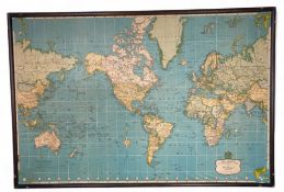
Reserve not met No Image Lot 205 A mid 20th century Daily Express International Map of The World by Jarrold & Sons Ltd, Norwich 205A mid 20th century Daily Express International Map of The World by Jarrold & Sons Ltd, Norwich The Pedestal A mid 20th century Daily Express International Map of The World by Jarrold & Sons Ltd, Norwich Mounted on a boarded frame, 85cm x 126cm Add to watchlist Timed
Reserve not met No Image Lot 642 Folding Maps. Scotland. Sifton, Praed & Co. Ltd. - Four folding divisional maps for Scotland. 642Folding Maps. Scotland. Sifton, Praed & Co. Ltd. - Four folding divisional maps for Scotland. 1818 Auctioneers Folding Maps. Scotland. Sifton, Praed & Co. Ltd. - Four folding divisional maps for Scotland. Circa 1930's. (4) Add to watchlist Timed
Reserve not met No Image Lot 668 Topography. Lewis, Samuel - A Topographical Dictionary of England, &c. Volume five only. Third 668Topography. Lewis, Samuel - A Topographical Dictionary of England, &c. Volume five only. Third 1818 Auctioneers Topography. Lewis, Samuel - A Topographical Dictionary of England, &c. Volume five only. Third edition. London: 1835. With maps. (1) Add to watchlist Timed
Reserve not met No Image Lot 687 Maps. Scotland. The Survey Atlas of Scotland: Centenary Limited Edition. No.223/800. Edinburgh: 687Maps. Scotland. The Survey Atlas of Scotland: Centenary Limited Edition. No.223/800. Edinburgh: 1818 Auctioneers Maps. Scotland. The Survey Atlas of Scotland: Centenary Limited Edition. No.223/800. Edinburgh: 2012. 68 plates. Original binding. (1) Add to watchlist Timed
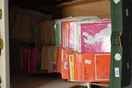
Reserve not met No Image Lot 688 Maps. A large quantity of Twentieth Century folding maps, mainly Ordnance Survey, Bartholomew's, 688Maps. A large quantity of Twentieth Century folding maps, mainly Ordnance Survey, Bartholomew's, 1818 Auctioneers Maps. A large quantity of Twentieth Century folding maps, mainly Ordnance Survey, Bartholomew's, etc. (quantity) Add to watchlist Timed
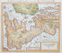
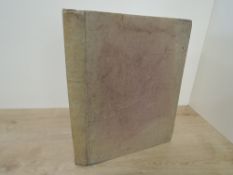
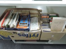
Reserve not met No Image Lot 67 Maritime Navigational Chart. Kattegat [Denmark]. London: James Imray and Son. 1863. Rolled chart 67Maritime Navigational Chart. Kattegat [Denmark]. London: James Imray and Son. 1863. Rolled chart 1818 Auctioneers Maritime Navigational Chart. Kattegat [Denmark]. London: James Imray and Son. 1863. Rolled chart backed on blue card. (1) Add to watchlist Timed
Reserve not met No Image Lot 1057 Box of Ordnance Survey and other maps. Not available for in-house P&P 1057Box of Ordnance Survey and other maps. Not available for in-house P&P Warrington & Northwich Auction Box of Ordnance Survey and other maps. Not available for in-house P&P Add to watchlist Timed
Reserve not met No Image Lot 136 A 19th century printed map of Bolton Le Sands, sold together with various other prints, to include a 136A 19th century printed map of Bolton Le Sands, sold together with various other prints, to include a 1818 Auctioneers A 19th century printed map of Bolton Le Sands, sold together with various other prints, to include a map of Great Britian, (11) Add to watchlist Timed
Reserve not met No Image Lot 1543 Framed map of Chester. Not available for in-house P&P 1543Framed map of Chester. Not available for in-house P&P Warrington & Northwich Auction Framed map of Chester. Not available for in-house P&P Add to watchlist Timed
Reserve not met No Image Lot 213 A group of ordnance survey maps, to include Isle of Arran Snodon and a Carnforth weekly newspaper 213A group of ordnance survey maps, to include Isle of Arran Snodon and a Carnforth weekly newspaper 1818 Auctioneers A group of ordnance survey maps, to include Isle of Arran Snodon and a Carnforth weekly newspaper ect Add to watchlist Timed
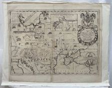
Reserve not met No Image Lot 216 Wells map of Eastern Europe, c.1700, “A New Map Of Sarmatia Europea Pannonia and Dacia”. By Edward W 216Wells map of Eastern Europe, c.1700, “A New Map Of Sarmatia Europea Pannonia and Dacia”. By Edward W Reeman Dansie Timed Wells map of Eastern Europe, c.1700, “A New Map Of Sarmatia Europea Pannonia and Dacia”. By Edward Wells, 1667-1727. Laid to wove paper. The map 4... Add to watchlist Timed
Reserve not met No Image Lot 301 G Mercator "Albion, Britannium et Hibernium" c1730, framed and glazed, 45cm x 50cm 301G Mercator "Albion, Britannium et Hibernium" c1730, framed and glazed, 45cm x 50cm Reeman Dansie Timed G Mercator "Albion, Britannium et Hibernium" c1730, framed and glazed, 45cm x 50cm Add to watchlist Timed
Reserve not met No Image Lot 302 J Speed, "The Countie of Nottingham", published by Sudbury & Humble, circa 1616, framed and glazed 4 302J Speed, "The Countie of Nottingham", published by Sudbury & Humble, circa 1616, framed and glazed 4 Reeman Dansie Timed J Speed, "The Countie of Nottingham", published by Sudbury & Humble, circa 1616, framed and glazed 46cm x 55cm Add to watchlist Timed
Reserve not met No Image Lot 303 J Speed, map of Buckinghamshire, handcoloured, published by Bassett & Chiswell, circa 1660, framed a 303J Speed, map of Buckinghamshire, handcoloured, published by Bassett & Chiswell, circa 1660, framed a Reeman Dansie Timed J Speed, map of Buckinghamshire, handcoloured, published by Bassett & Chiswell, circa 1660, framed and glazed 59cm x 70cm Add to watchlist Timed
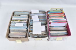
Reserve not met No Image Lot 217 THREE BOXES OF COLOUR AND BLACK AND WHITE POSTCARDS OF UK TOWNS, CITIES, VILLAGES AND 217THREE BOXES OF COLOUR AND BLACK AND WHITE POSTCARDS OF UK TOWNS, CITIES, VILLAGES AND Richard Winterton Auctioneers THREE BOXES OF COLOUR AND BLACK AND WHITE POSTCARDS OF UK TOWNS, CITIES, VILLAGES AND LANDMARKS, including views in Somerset, Bournemouth, Lynton,... Add to watchlist Timed
Reserve not met No Image Lot 218 THREE BOXES OF COLOUR AND BLACK AND WHITE POSTCARDS OF UK TOWNS, CITIES, VILLAGES AND 218THREE BOXES OF COLOUR AND BLACK AND WHITE POSTCARDS OF UK TOWNS, CITIES, VILLAGES AND Richard Winterton Auctioneers THREE BOXES OF COLOUR AND BLACK AND WHITE POSTCARDS OF UK TOWNS, CITIES, VILLAGES AND LANDMARKS, including views in Seaton, Sidmouth, Tintern Abb... Add to watchlist Timed
No Image Lot 896 TWO ALBUMS OF POSTCARDS containing 309 miscellaneous examples from the early 20th century, 896TWO ALBUMS OF POSTCARDS containing 309 miscellaneous examples from the early 20th century, Richard Winterton Auctioneers TWO ALBUMS OF POSTCARDS containing 309 miscellaneous examples from the early 20th century, subjects include topographical views, cities, towns, re... Add to watchlist Live
No Image Lot 330 Four ‘escape’ style maps printed on silk type material, three printed double-sided; North Norway, 330Four ‘escape’ style maps printed on silk type material, three printed double-sided; North Norway, Gorringes Four ‘escape’ style maps printed on silk type material, three printed double-sided; North Norway, 47x49cm, parts of Italy and Greece, 53x62cm, par... Add to watchlist Live
No Image Lot 706 After Sebastian Munster (1489-1552), hand coloured engraved map of England, 33 x 37cm 706After Sebastian Munster (1489-1552), hand coloured engraved map of England, 33 x 37cm Gorringes After Sebastian Munster (1489-1552), hand coloured engraved map of England, 33 x 37cm Add to watchlist Live
No Image Lot 724 John Speed (1552-1629), 17th century hand coloured engraved map of Kent, text and Magna Gallery, 724John Speed (1552-1629), 17th century hand coloured engraved map of Kent, text and Magna Gallery, Gorringes John Speed (1552-1629), 17th century hand coloured engraved map of Kent, text and Magna Gallery, Oxford, label verso, 39 x 51cm Add to watchlist Live


![Maps/Atlases. Two titles: Bartholomew, J. G. [ed.] - The Royal Atlas of England and Wales. London:](https://portal-images.azureedge.net/auctions-2025/sr1811211/images/3fb8c493-9cb6-4bfc-b2b1-b30700f38b09.jpg?h=175)
![Maritime Navigational Chart. Kattegat [Denmark]. London: James Imray and Son. 1863. Rolled chart](https://portal-images.azureedge.net/auctions-2025/sr1811210/images/b9eb121e-02e3-42a9-bc86-b30700d0995f.jpg?h=175)