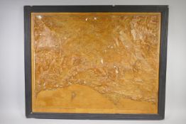

A vintage contour relief model map of the Greater Part of Dorset, prepared from the Ordnance Survey by G.R.C. Feigerl, 80 x 64cm
Ordnance survey map
25 item(s)
Filtered by:
- Category,
- Item Type
- List
- Grid
-
25 item(s)/page
Lot 2331
An early/mid-20th century 'Ordnance Survey Motor Map, Scale: 4 Miles to 7 inch' by T. Fisher
An early/mid-20th century 'Ordnance Survey Motor Map, Scale: 4 Miles to 7 inch' by T. Fisher Unwin, London, consisting of thirty celluloid-covered...
Lot 688
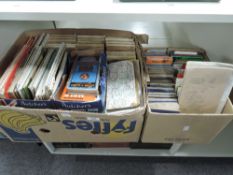
Maps. A large quantity of Twentieth Century folding maps, mainly Ordnance Survey, Bartholomew's,
Maps. A large quantity of Twentieth Century folding maps, mainly Ordnance Survey, Bartholomew's, etc. (quantity)

Lot 213
A group of ordnance survey maps, to include Isle of Arran Snodon and a Carnforth weekly newspaper
213A group of ordnance survey maps, to include Isle of Arran Snodon and a Carnforth weekly newspaper
A group of ordnance survey maps, to include Isle of Arran Snodon and a Carnforth weekly newspaper ect
Lot 3436
Cartography – Derbyshire maps: Muchison (Roderick Impey), Geological Map of England and Wales, 1843,
Cartography – Derbyshire maps: Muchison (Roderick Impey), Geological Map of England and Wales, 1843, 35 x 42cm, 12 fold, marbled rev. and inside r...
Lot 4377
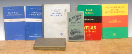
Books – Railway interest, maps: Cheffins Map of the Railways of Great Britain from the Ordnance
Books – Railway interest, maps: Cheffins Map of the Railways of Great Britain from the Ordnance Survey, 10 miles: 1 inch, fabric backed colour pri...
Lot 4452
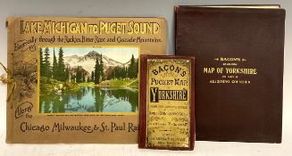
Cartography etc. – Railway interest: Bacon’s Pocket Map of Yorkshire, from the Ordnance Survey
Cartography etc. – Railway interest: Bacon’s Pocket Map of Yorkshire, from the Ordnance Survey with the Name of Every Railway Station, London, G W...
Lot 1170
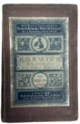
JOHN BARTHOLOMEW: REDUCED ORDNANCE SURVEY MAP FOR TOURISTS - NORWICH AND ENVIRONS, London, W H Smith
JOHN BARTHOLOMEW: REDUCED ORDNANCE SURVEY MAP FOR TOURISTS - NORWICH AND ENVIRONS, London, W H Smith and Son. Linen backed and printed label paste...
![SCOTLAND, FIFE Extremely large wall map c1894 [dated 1893 to the loch]. Ordnance Survey Office](https://portal-images.azureedge.net/auctions-2025/srkey11201/images/80abfbfd-de74-46c5-976e-b30e00bad742.jpg?h=175)
Lot 1296
SCOTLAND, FIFE Extremely large wall map c1894 [dated 1893 to the loch]. Ordnance Survey Office
SCOTLAND, FIFE Extremely large wall map c1894 [dated 1893 to the loch]. Ordnance Survey Office Southampton. Measuring; 166cm x 125cm. With colour ...
Title: Antique 139 Years-Old Scarce Map County of Devon 1885 Boundary Changes.Description: Antique 139 Years-Old Scarce Map County of Devon 18...
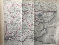
Title: Antique 139 Years-Old Scarce Map County Essex 1885 Boundary Changes.Description: Antique 139 Years-Old Scarce Map County Essex 1885 Bou...
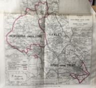
Title: Antique 139 Years-Old Scarce Map Stoke On Trent 1885 Boundary Changes.Description: Antique 139 Years-Old Scarce Map Stoke On Trent 1885...
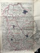
Title: Antique 139 Years-Old Scarce Map Lincolnshire 1885 Boundary Changes.Description: Antique 139 Years-Old Scarce Map Lincolnshire 1885 Bou...
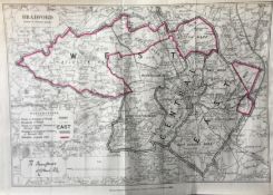
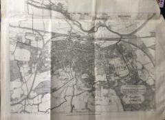
Title: City of Bradford Antique 139 Years-Old Scarce Map 1885 Boundary Changes.Description: Antique 139 Years-Old Scarce Map City of Bradfor...
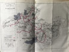
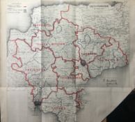
Title: South West Riding Yorkshire Antique 139 Years-Old Scarce Map 1885 Boundary Changes.Description: Zincographed Ordnance Survey Map Produc...
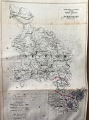
Title: North West Riding Yorkshire Antique 139 Years-Old Scarce 1885 Boundary Change MapDescription: Zincographed Ordnance Survey Map Produced...
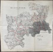
Title: County of Middlesex & London Antique 139 Years-Old Scarce 1885 Boundary Changes MapDescription: Antique 139 Years-Old Scarce Map County...
Title: Antique 139 Years-Old Scarce Map City of Reading 1885 Boundary Changes.Description: Antique 139 Years-Old Scarce Map City of Reading 18...
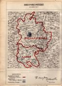
Title: Antique 139 Years-Old Scarce Map of Bedfordshire Boundary Changes 1885.Description: Antique 139 Years-Old Scarce Map of Bedfordshire B...
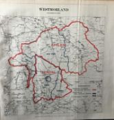
Title: Lake District Antique 139 Years-Old Scarce Coloured 1885 Boundary Changes MapDescription: Antique 139 Years-Old Scarce Map Lake Distri...
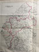
Title: Antique 139 Years-Old Scarce Map Lake District Cumbria 1885 Boundary Changes.Description: Antique 139 Years-Old Scarce Map Cumbria 1885...
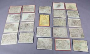
Lot 311
A COLLECTION OF TWENTY ONE EARLY 20TH CENTURY ORDNANCE SURVEY MAPS, SOME RELATING TO MILIARY
A COLLECTION OF TWENTY ONE EARLY 20TH CENTURY ORDNANCE SURVEY MAPS, SOME RELATING TO MILIARY OPERATIONS, DATED 1909
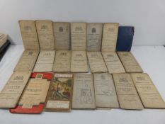
A COLLECTION OF TWENTY ONE EARLY 20TH CENTURY ORDNANCE SURVEY MAPS
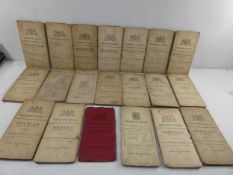
A COLLECTION OF TWENTY EARLY 20TH CENTURY ORDNANCE SURVEY MAPS
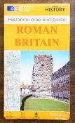
Ordnance Survey, Roman Britain. Historical Map and guide. Very good condition.